Abineau-Bear Jaw Loop

7 Mile Loop


Drive northeast of Flagstaff on US 89 for 12 miles to FR 420 directly across from the Sunset Crater turnoff. Turn left (west) for about 1/2 mile, turn right (north) on Forest Road 552. Turn right at Forest Road 418 and go approximately 7 miles to Forest Road 9123J. Turn left (south) on Forest Road 9123Ja for 1.2 miles to the trailhead. These two trails make a loop through forested canyons. Both end at an old road along the base of a long talus slope topped by Humphreys Peak, Arizona's highest point. The climb along either trail is steep and steady through stands of mixed conifer and aspen. The road completes the loop by connecting the top of one trail to the other.
Anderson Mesa
11.6 Miles RT
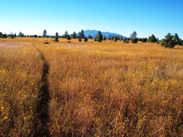
This hike starts in a good wildlife-viewing area and traverses a section of the Arizona Trail across Anderson Mesa to a scenic viewpoint overlooking Walnut Canyon. You�ll start near the shore of Marshall Lake, which is usually more of a marsh than a lake.
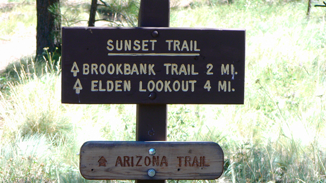
Arizona Trail


The paved trail travels through the middle of town, from Interstate 40 to Route 66. This trail is part of an 800-mile trail that crosses Arizona from Mexico to Utah, and the only passage through an urban area. The southern end of the trail follows a rolling alignment through the Ponderosa pine forests south of Flagstaff. This section is less developed than other FUTS trails; it is only four to six feet in width and can be rocky in spots. The north end of the trail hugs the east rim of McMillan Mesa and provides great views all around. The trail crosses Cedar Avenue on the Matt Kelly Urban Trail Bridge, then continues north through the heart of Buffalo Park. North and south of Flagstaff the Arizona Trail continues on single-track trails on Coconino National Forest land.
Arroyo Trail
.6 Mile RT


Starts at Pine Knoll Trail and drops into a small canyon adjacent to Interstate 40.
Aspen Loop Trail #73
6 Miles RT
From Flagstaff drive north on US 180 for 7 miles to FR 516, the Snowbowl Road. Drive 7 miles on this paved road to the lower parking lot of the Snowbowl facility. The trailhead is located at the north end of the parking lot. Beginning at the Humphreys Trailhead and branching west, the way leads through micro habitats where sun-loving wildflowers and grasses alternate with shade plants and ferns along the trail�s winding, 300-foot elevation change.
Barringer Crater
From Flagstaff, AZ: Head east on I-40 about 35 miles. Take the Meteor Crater Road exit (exit 233) and turn right. Drive about 5 miles and you will see the crater.
From Winslow, AZ: Head west on I-40 about 18 miles. Take the Meteor Crater Road exit (exit 233) and turn left. Drive about 5 miles and you will see the crater.
Formed about 40,000 years ago, the Barringer Crater is the best known and best preserved impact crater on Earth. The crater is named after Daniel Barringer who was first to suggest that it was produced by a meteorite impact. The crater is still privately owned by his family and is also simply known as Meteor Crater or Arizona Crater. Measuring about 1,200 meters (4,000 feet) in diameter and 170 meters (570 feet) deep, with a rim 45 meter higher on average than the surrounding plain, the crater lies near Flagstaff.
Bill Williams Mountain Trail
7.65 Miles RT
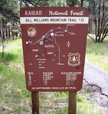
From Williams go west from the downtown on Bill Williams Avenue about one mile; turn left at Clover Hill and proceed along the frontage road to the turnoff to Williams Ranger District office. Follow the signs to the trailhead. The trail accesses the summit of Bill Williams Mountain via the north face. The trail quickly climbs in the 1st mile with the route leveling off for most of the 2nd mile. At 0.15 miles you will meet a side trail that takes off for Clover Springs to the left meeting back up to the main trail at 0.9 miles. Past the 2-mile point the trail begins to climb up steadily towards to summit and reach the gravel road (FR111) that accesses the fire lookout tower and the radio towers on the summit. The intersection of the trail and FR111 has a nice area with log benches. You can continue to hike up along FR111 to the summit and checkout the 360-degree views of the area peaks from the fire lookout tower.
Bismark Lake Trail


From Flagstaff take 180 N, turn right on FR 151 (Hart Prairie Rd), turn right again on FR 627 and follow to trailhead. Bismark Lake Trail is 1.5 miles long and terminates into the Arizona National Scenic Trail to the east. Bismark Lake is an important water source for wildlife in the area but is often dry during the driest months of the year.
Bow & Arrow Trail
The trail follows the Bow & Arrow Wash along the grassy bottom of a wide, scenic canyon. On the west side of Lone Tree Road, the trail is also parallel to Zuni Drive.
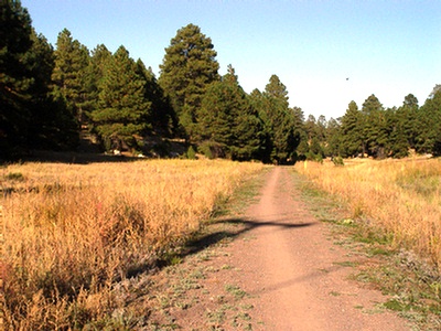
Buffalo Park Loop


2 Mile Loop
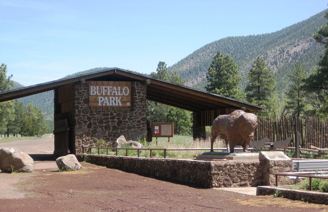
From the City Hall go north along Humphrey's St. to Columbus. Turn right and go one block east to Beaver St. Turn left and go up hill to Forest Avenue. Turn right onto Forest Avenue and travel roughly two miles. Turn left on Gemini Drive. This will take you straight to the park area of Buffalo Park. Buffalo Park is city owned positioned on an open plain atop a mesa. It has incredible views of the San Francisco Peaks and Mount Elden. Buffalo Park once operated as a zoo in the 1960's, but soon was shut down due to lack of funds. A buffalo statue and a rock structure at the entrance are all that remain. Since then this area has become a popular recreational site for runners, hikers, wildlife viewers, dog walkers, mountain bikers... you name it. The Buffalo Park trail system actually consists of three trails. All trails are wide and well-maintained. There are mile markers every 1/4-mile and stations where you can do some added exercises like chin-ups, etc. Each station has a sign that indicates a recommended exercise to do at that location. The First trail is a 0.50-mile straight shot north from the entrance archway. It travels along a well-graded road straight to the rear of the park boundary. Here at the fence line you can connect to the Oldham Trail, a 3.3-mile trail traveling along the west side of Mount Elden. The Second trail is a 2.0-mile loop around the park. Just after you enter the park through the archway, you'll see a trail fork off from the first trail to the right. The beginning of the trail loops around to the east of the first trail and then crosses it at the north end, now heading west. The trail completes the loop near the entrance of the park where you came in. The Third trail is a 0.50-mile one-way trek on the outside of the park. It follows an old road west and southwest downhill to the corner of Cedar and Turquoise Drive. You pass McFerson Park along the way. This trailhead is located at the southwest corner of the Buffalo Park parking area.
Cedar Trail
This trail includes two separate segments. The east half climbs 150 feet on the east slope of McMillan Mesa through open forest and grasslands. The trail is parallel to Cedar Avenue, but it is buffered from the road by a band of open space. The climb is steady and can be steep at times, especially near the top. The west half also parallels Cedar Avenue and Forest Avenue, from Gemini Drive to Turquoise Drive, in a band of open space. The trail descends the west slope of the Mesa in a series of long, gradual stair steps. The last step is the steepest and has a steady grade of 10 percent.
Country Club Trail
1.8 Miles RTAdjacent to the east side of Country Club Drive. A new section of trail near Country Club�s intersection with Highway 89 connects to the Route 66 and Winifred Ranch Trails, and provides access to the Flagstaff Mall area to the east and central Flagstaff to the west. Through the Interstate 40 interchange and overpass, trail users can make the connection via an existing sidewalk.
Dry Lake Trail
1.6 Miles RT
Located along the south side of Kiltie Lane adjacent to W.L. Gore�s Woody Mountain campus. The Dry Lake trail is a short trail on the western side of Flagstaff. It extends from Woody Mountain Rd. to Flagstaff Ranch Rd.
Elden Lookout Trail
5 Miles RT


Follow Santa Fe Ave past the Flagstaff Mall and the Peaks Ranger District Office to the trailhead parking lot just off the north side of the street. This is a popular trail, so parking may be limited. Go through 2 gates and you will be headed right up to Mt.Elden. Short and strenuous ascending 2000ft in about 2 miles with great views of Flagstaff and Coconino plateau, with some interesting terrain described as "Corduroy cast in stone" and "Staircase of petrified lava" makes this trail a must do.
Fatmans Loop Trail


Follow Route 66 (which becomes Highway 89) past the entrance to the Flagstaff Mall and the Flagstaff Ranger District Office to a trailhead parking lot just off the north side of the street. For the most part, the Fatmans Loop is an easy walk, although it does have a few short steep sections. Scenic overlooks of Flagstaff, the city's eastern suburbs and the surrounding countryside make this a good place for a stroll when you have time to stop and enjoy the view. Along the route there are a number of interesting rock formations that bear witness to Mt. Elden's volcanic origins. One of these is a bit of a tight squeeze, hence the trail's name.
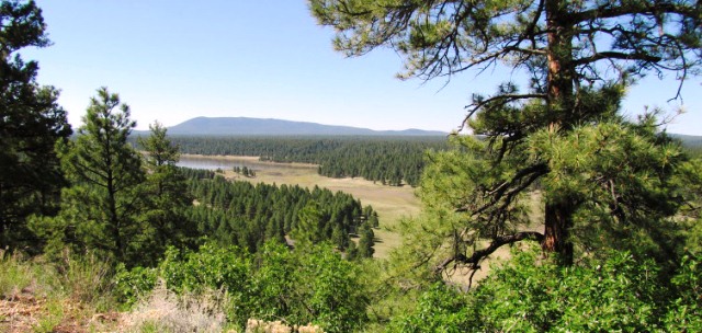
Fisher Point Trail via Sandy�s Canyon
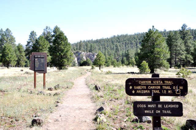
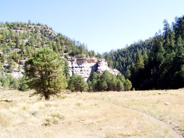
Follow Route 66 (which becomes Highway 89) past the entrance to the Flagstaff Mall and the Flagstaff Ranger District Office to a trailhead parking lot just off the north side of the street. For the most part, the Fatmans Loop is an easy walk, although it does have a few short steep sections. Scenic overlooks of Flagstaff, the city's eastern suburbs and the surrounding countryside make this a good place for a stroll when you have time to stop and enjoy the view. Along the route there are a number of interesting rock formations that bear witness to Mt. Elden's volcanic origins. One of these is a bit of a tight squeeze, hence the trail's name. Just south of Flagstaff near Lower Lake Mary on paved forest roads. Drive southeast out of Flagstaff 6 miles on Lake Mary Road (Forest Highway 3). Take the road into Canyon Vista Campground on left going south. This trail joins the Fisher Point to Marshall Lake section of the Arizona Trail. Here is a trail just a few minutes outside Flagstaff that offers good photo opportunities, interesting geology, great views, and access to a longer trail that stretches all the way across Arizona. Sandys Canyon Trail starts out by skirting the rim of Walnut Canyon, a scenic rift in the same layers of rock that form the upper cliffs of the Grand Canyon. From the trailhead, you get a great view of the San Francisco Peaks with the cliffs of Walnut Canyon in the foreground. The trail heads north from the trailhead following the Walnut Canyon Rim for a short distance before it drops down Sandys Canyon into the main gorge. Sandys Canyon Trail then continues along the Walnut Canyon floor on an old jeep track to an intersection with the Arizona Trail.
Heart Trail
The best access to the Heart Trail, would be to begin at the Sandy Seep trailhead. This is 1.5 miles north of the Flagstaff Ranger District on Highway 89, just past Elden Pueblo, on the west side of the highway. The trail can be reached by the Fatman Loop Trail and the Little Elden Trail. Equestrian parking is limited, but additional equestrian parking is located at the trailhead west of the Little Elden Spring horse camp on FR 556. The Heart trail begins in the Sandy Seep area just north of Flagstaff at 7200 feet, and climbs the east slope of Mt. Elden to connect with the Sunset Trail in Sunset Park. As the trail climbs, it winds through the remnants of a large mixed conifer forest which was destroyed by the Radio fire in 1977. The area is well into regeneration, with gamble oak and various grasses and shrubs growing strong.
Humphrey�s Trail
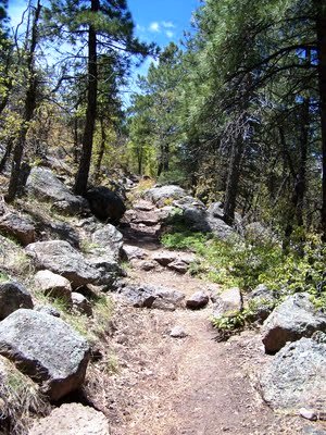
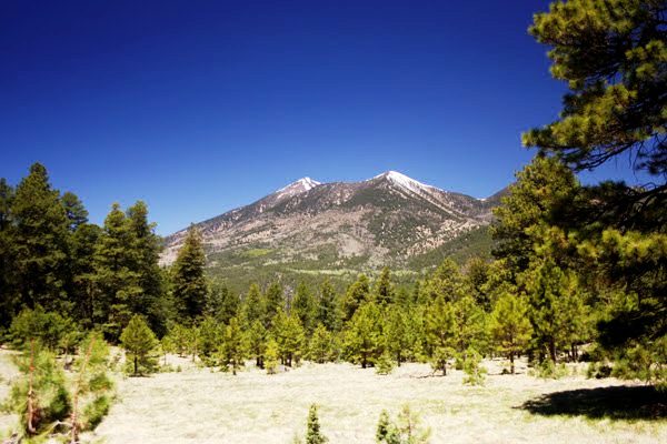
From Flagstaff drive north on US 180 for 7 miles to FR 516, the Snowbowl Road. Drive 7.4 miles on this paved road to the lower parking lot of the Snowbowl facility. The trailhead is located at the north end of the parking lot. This steep mountain trail leads to the highest point in Arizona. Humphreys Trail is steep, long and extremely rocky in its higher reaches. Once you do reach the summit ridge you'll feel like you're standing on top of the world. Off in the distance, the Grand Canyon, the Painted Desert, the mesas that are home to the Hopi Indians the Verde Valley and Oak Creek Canyon form a 360deg. panorama.
Inner Basin Trail
Drive northeast of Flagstaff on US 89 for 12 miles to FR 420 directly across from the Sunset Crater turnoff. Turn left (west) for about 1/2 mile, turn right (north) on Forest Road 552. Turn right at the Lockett Meadow sign and continue to the trailhead. This road is closed in early spring and late fall due to snow. The trail into the heart of the ancient volcano begins in Lockett Meadow. From this island it follows a primitive road into the mountain's Inner Basin and then connects to the Weatherford trail.
Island Trail

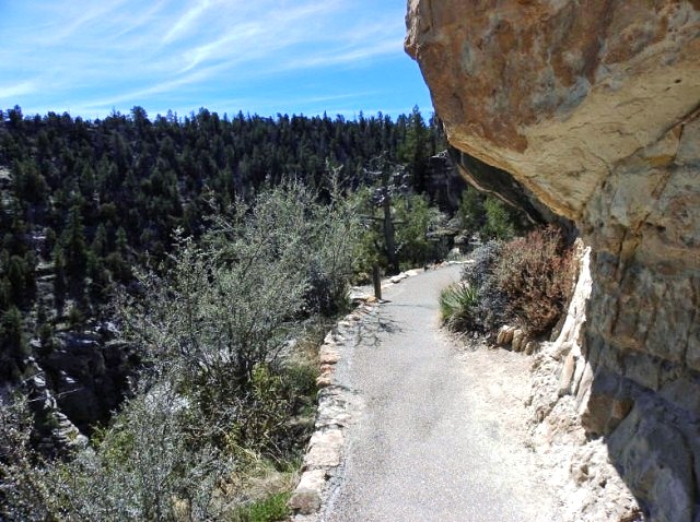
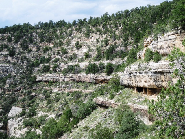
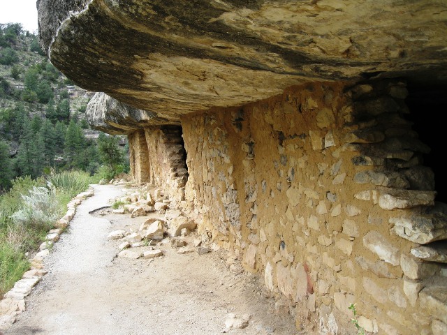
8 miles east of Flagstaff via Interstate 40. Take Walnut Canyon Exit, three miles to the visitor center. The Island Trail descends down into the canyon. Less than a mile round trip, this trail is strenuous because hikers must climb 240 steps back up to the visitor center. If you�re fit enough, this hike provides a close up view of the cliff dwellings.
Johnson Canyon Railroad
6 Miles RT


Start your hike from the trailhead near the abandoned settlement of Welch Station located near the intersection of FR6 and the abandoned Santa Fe railway right-of-way. The trek to the Johnson Canyon Tunnel offers an easy historical hike that includes many wildflowers along the way.
Kachina Trail
10 Miles RT


Drive 7 miles northwest of Flagstaff on US 180 and turn north on the Snowbowl Road (FR 516). Follow this paved road 7 miles to the Snowbowl Ski Area. Drive into the first parking lot on the right. The Kachina trailhead is located at the south end of the parking lot. This trail is one of Flagstaff�s most popular. Skirting the south face of the Peaks, the trail runs almost entirely within Kachina Peaks Wilderness. The trail crosses several canyons and even descends a high lava cliff. A dramatic, cave-like recess in the lava marks where a bed of looser volcanic debris eroded away from denser flow layers above. Although you can enjoy short forays onto the trail from here, many hikers leave a car at the end of Friedlein Prairie Road (FR 522) so they can begin here and do the entire trail one way.
Kelsey Springs Loop


To get to the trailhead from Flagstaff take HWY-66 West out of town, turning South onto Woody Mt Road (FR231). This road starts off as paved and then turns into good graded dirt. Follow this road 14 miles to FR583. Make a right turn onto FR583 and take it 5.7 miles to FR538E. At this point high clearance vehicles are recommended. Turn right on FR538E and go 0.4 miles to FR538G. Stay right on FR538G for 1.0 miles and turn left at the sign for Kelsey Spring trail, going the last 0.4 miles to the well signed trailhead. The well marked trailhead starts from the parking area. The trail drops steadily down the side of the Sycamore Creek Canyon to Kelsey spring. All to quickly, you will have walked 0.5 miles and reach the spring on your right. The perennial spring has been tapped by a black rubber tube into a cement container. From here you can either continue on the same trail 0.7 miles to Babe's Hole and another 0.8 miles to Geronimo Spring.
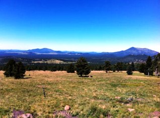
Kendrick Peak Trail

9 Miles RT


From Flagstaff, drive north 15 miles on US 180 to mile marker 230, and turn left on a graded dirt road (FS 245). Continue 3.1 miles, then turn right on another graded dirt road (FS 171). Drive 3.2 miles, then turn right on another graded dirt road (FS 190) and continue 0.4 miles to the trailhead. There are numerous signs for this well-developed trailhead along the way.
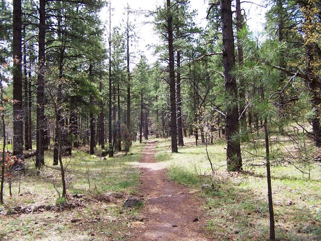
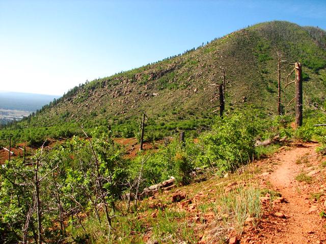
Kendrick Peak is a stand-alone volcanic mountain 10,413 feet high. The hike starts below 8000' and has an elevation gain of +-2700'. The Kendrick Peak Trail, originally built to maintain the Forest Service�s fire lookout tower on the peak, is the easiest of three trails to the summit of Kendrick Peak, the second highest mountain (outside of the San Francisco Peaks) in northern Arizona. This is a well-graded, scenic trail up the forested slopes of Kendrick Peak and rewards the hiker with spectacular views from the summit. The first 1.25 miles of the Kendrick Peak Trail follows the original fire road, before giving way to a foot trail. The trail is almost entirely uphill, gaining 2,418' of elevation before reaching the summit. 1/4 mile from the summit, the trail reaches a saddle, where there is an old fire lookout, built in 1912. It was occupied until the 1930s, when the new lookout was built on the summit. The old cabin house is furnished with two cots for overnight hikers. The Bull Basin Trail, which climbs the north face of the mountain, connects with the Kendrick Mountain Trail at this saddle. Continue up the trail to the summit lookout via Kendrick Mountain Trail. Your reward for reaching the summit is a possible visit inside the lookout tower and stunning views of the San Francisco Peaks, dominating the skyline to the east. On a clear day, the Grand Canyon and the Vermilion Cliffs can be seen to the north. Oak Creek Canyon and Mingus Mountain can be located to the south, while Bill Williams and the Sitgreaves Mountains can be spotted to the west. The hundreds of old volcanoes and cinder cones scattered throughout the area are testimony to the violent volcanic history of this region, known as the San Francisco Volcanic Field.
To access the Bull Basin-Pumpkin Trail from Flagstaff, take Hwy 180 north to FR 245, about 8 miles north of the turnoff to the Arizona Snow Bowl; turn left on FR 245 and continue to FR 171. Turn right on FR 171 and continue on FR 171 to FR 149 just south of a curve in the road for FR 171, and take a right. Continue for about one mile to the parking area at the trailhead.
The Pumpkin Trail initially, this trail follows an old road then rises along a steep canyon. After passing through a gate, the trail ascends a ridge, gradually turning southeast. From here to the top of Kendrick Mountain, the trail follows a ridge through meadows, aspen and conifer stands.
Bull Basin trail ascends Kendrick Mountain's north slope, it switchbacks up to a large meadow. The trail then turns south along a rocky ridge to a flat area where there is a spring, and on to the old Kendrick Lookout Cabin. Be sure to go up to the lookout to enjoy the view. The two springs along the trail are not reliable and not recommended for drinking. The lower section of Bull Basin Trail follows some old logging roads and then merges with the Connector Trail, which branches off to the west. Bull Basin proceeds east, passing a small meadow. About 1/4 mile beyond the meadow the trail begins a steep ascent. It then curves south at another large meadow near the top of Kendrick Mountain, passing a spring before reaching the old Kendrick Lookout Cabin. The trail is generally well marked. The old cabin can be used by visitors, but please leave it in good shape for the next person.
Lake View Trail
2.50 Miles RT

From the Phoenix area, take I-17 North to the point where I-40, I-17, and HWY89A meet. Take the Lake Mary Road exit and head south. Go about 20 miles on this road to the turnoff to the Mormon Lake Road on the right. Turn right here and go 5.0 miles to the turnoff to the Double Spring Campground. Follow the signs for the Lakeview Trail that starts near the entrance to the campground. This hike starts near the front of the Double Spring campground and is well signed. Starting by crossing a small stream, the trail is well established and easy to follow. While the trail gains steadily in elevation, it never feels steep. The trail winds through a pine forest for the entirety of the hike. After 1.25 miles of hiking, you reach a rocky overlook that reveals views of Mormon Lake.
Lava Flow Trail - Sunset Crater Volcano
1 Mile Loop


From Flagstaff, take U.S. 89 north for 12 miles, turn right on the Sunset Crater - Wupatki Loop Road and continue 2 miles to the visitor center. The trailhead is just one and a half miles past the visitor center on the right hand side of the road. There is paved parking and restrooms at the trailhead. This is a great family hike with only one mile of hiking it is perfect for small children. There is an interpretive trail guide book found at the trailhead that coincides with numbered markers along the trail which is great opportunity to learn more about the volcano and the lava flow.
Lava River Cave
2 Miles RT
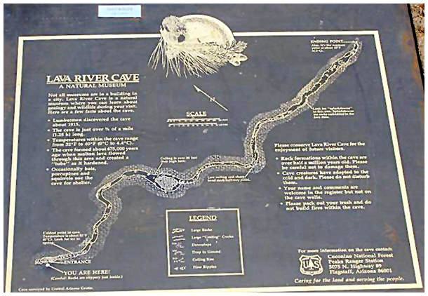
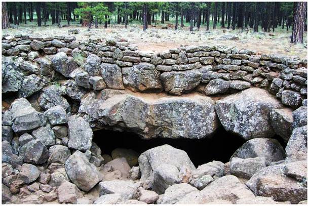
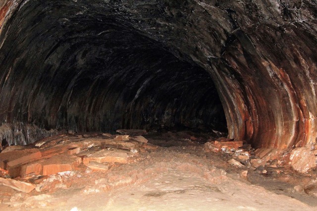
From Flagstaff, go northwest on US 180 to mile marker 230 (9 miles). Turn left on FR 245 and follow it 3.6 miles to its intersection with FR 171. Turn left on FR 171 and go 1.0 mile to FR 171B. Follow this .25 mile until its end. The cave entrance is 300 yards east of the end of the road. Look for a large circle of rocks that mark the cave entrance. This hike will take you 1.5 miles round trip underground so make sure you have plenty of batteries for your flashlight. The cave floor is very rocky and uneven. This very unusual hike will take you down a 700,000 year old lava tube discovered by lumbermen around 1915.
Lees Ferry
1.37 Miles RT-Easy
Lees Ferry is 42 miles from Page via Hwy 89 south and Hwy 89A west. It is 85 miles from the North Rim of the Grand Canyon via Hwy 89A and Hwy 67. The Lees Ferry Junction and Park Entrance is just west of Navajo Bridge Interpretive Center. A paved road leads 5 miles to the Ferry area. Services available at Lees Ferry include a National Park Service, campground, ranger station, dump station and public launch ramp. There is a gas station, store, post office, motel and restaurant at Marble Canyon, next to the park entrance. More services are found west on Hwy 89A. This trail takes you through the historic town of Lees Ferry, past a steamship wreck, and along the upper reaches of the Grand Canyon. Expect no shade along this route. You'll spot plenty of rusting equipment and sandstone ruins left by Lee, a mining company, and various drifters. Magnified by its proximity, the Colorado River -- which seems green from the rims -- flows deep blue indigo. Be sure to visit the Navajo Bridges, the steel spans that replaced the primitive ferry at this point.
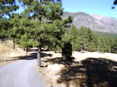
Oldham Trail
11 Miles RT


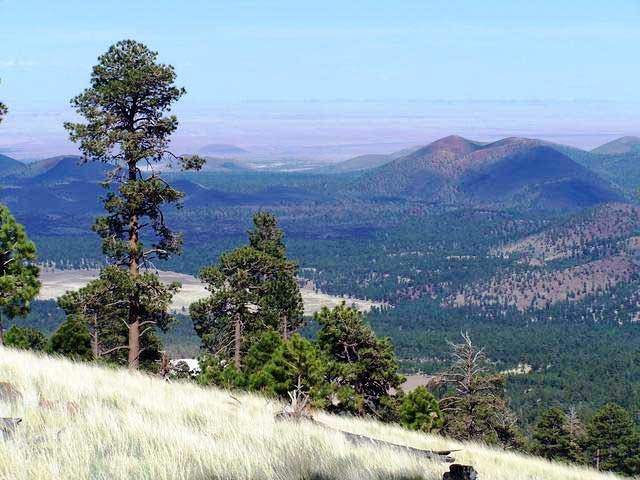
The Buffalo Park parking lot is located on Cedar Street in north central Flagstaff. Another access point is on FR 557, the Mt. Elden Road, off US 180 north. Oldham Trail begins in Buffalo Park, Flagstaff's urban forest park, and climbs gradually up the south slope of Mt. Elden, an extinct volcano. The trail gets its name from Oldham Park, an open area near Elden's summit. From that high perspective you'll get a bird's eye view of Flagstaff and the surrounding area including mountains, deserts, and canyons as much as a hundred miles away. Some prominent features that are easily visible are Oak Creek Canyon, Sunset Crater, and the Painted Desert. Along the lower reaches of the trail, you'll encounter boulder fields and cliffs where there are hidden crevices to explore and rocky nooks that make great places to picnic. Near Elden Summit, Oldham Trail joins the Sunset Trail which leads north across the top of Elden to Schultz Pass and south to the Elden Lookout Trail and east Flagstaff.
Schultz Creek Trail


Drive north from Flagstaff 2 miles on US 180 to FR 420 (Schultz Pass Road). Turn east and follow FR 420 about a mile to a gate and cattle guard. Turn right down over the hill toward Schultz Creek and park. The trailhead is at the north end of the parking area. The Schultz Creek Trail follows the course of the old Schultz Pass Road and the Schultz Creek. It is an easy going trail with few rocks. The trail is always close to the road, which along with the traffic, are the only aspects taking away from the natural feel of the trail.
Sunset Trail

Drive north out of Flagstaff on US 180 to FR 420 (Schultz Pass Road). Drive 6 miles east on FR 420 to the trailhead at a parking lot on the south side of the road. Views of the San Francisco Peaks, the volcanic fields east of Flagstaff, Sunset Crater and even the Painted Desert are yours to enjoy along this trail. The route starts near Schultz Tank, then climbs gradually to a high ridge where you'll find good views of Arizona's tallest mountain before continuing on to the east edge of Mount Elden's summit plateau. From this high perspective you can look down on Sunset Crater and the huge Bonito Lava Flow that borders it.
Sunset Crater
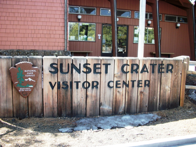
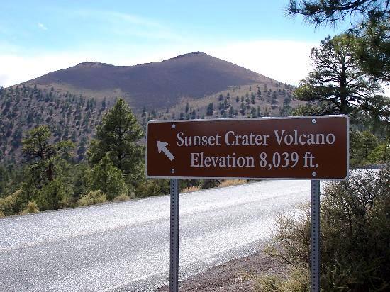
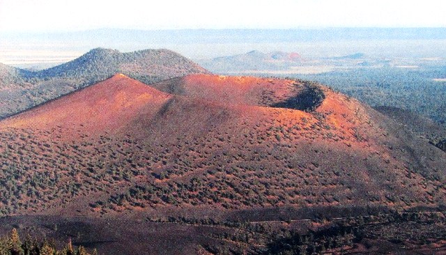

From Flagstaff, take U.S 89 north for 12 miles (19km), turn right on the Sunset Crater - Wupatki Loop road and continue 2 miles (3km) to the visitor center. Sunset Crater Volcano! Roughly 900 years ago, the eruption of this volcano reshaped the surrounding landscape, forever changing the lives of people, plants and animals. Hike the trail through the lava flow and cinders and you�ll likely discover colorful, ruggedly dramatic geological features coexisting with twisted Ponderosa Pines and an amazing array of wildlife.
