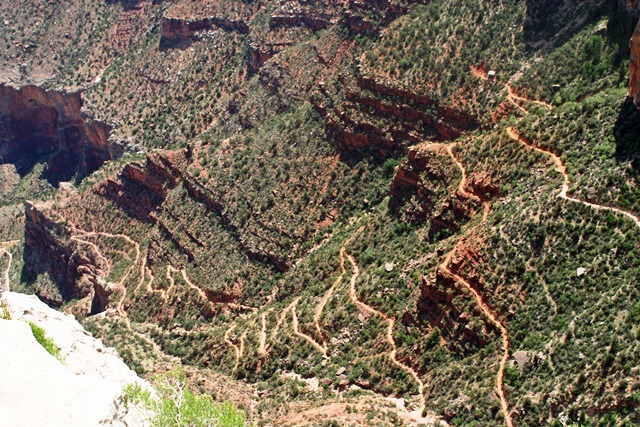
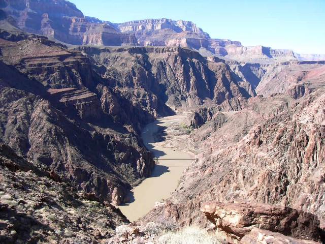
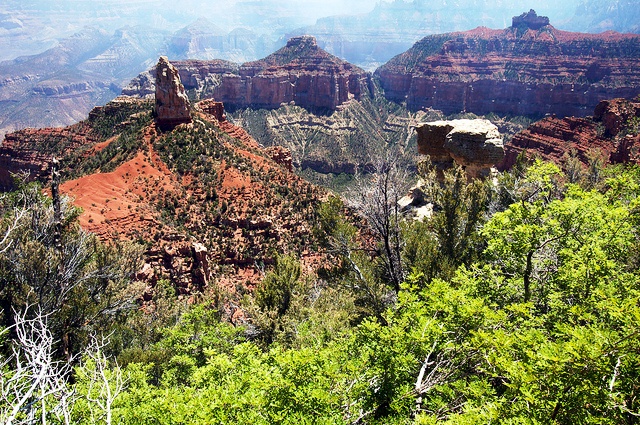
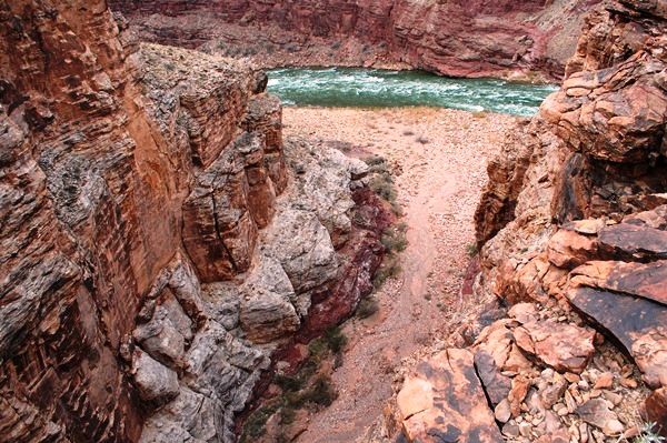
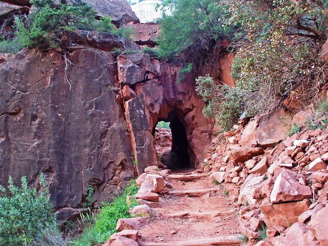
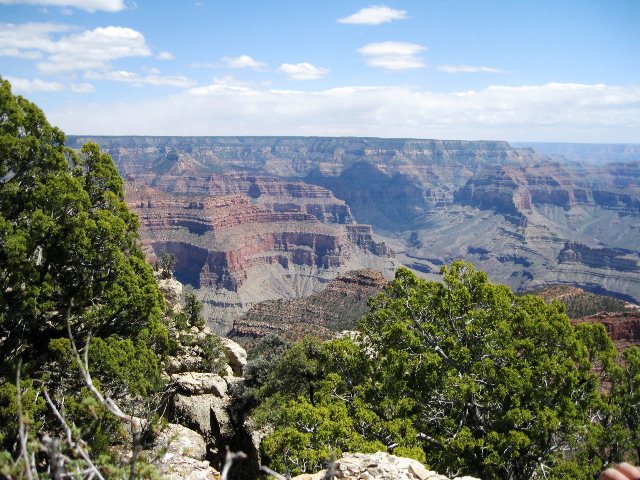
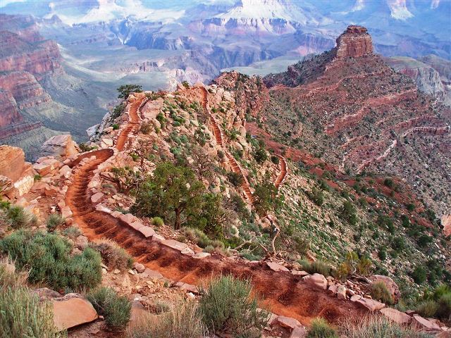
Bill Hall Trail


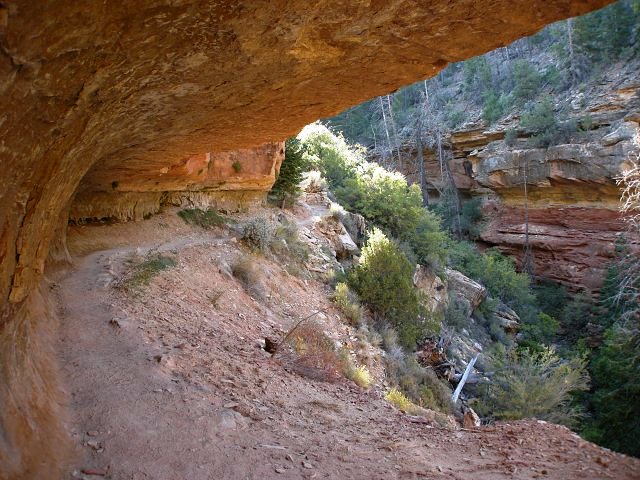
The trail begins at Monument Point along the north rim of the canyon on the boundary of the National Park, about 20 miles west of the park services at North Rim, Arizona. Access to the trailhead is over 35 miles of forest roads made of graded dirt, and a four-wheel drive vehicle is recommended for travel in the area. The Bill Hall Trail was originally just another entry point into the Canyon for the Thunder River Trail. The main Thunder River trail descends into the Canyon from Indian Hollow which is about 4 miles west of the trailhead of the Bill Hall Trail. Using the Thunder River trail from its start will add about 5 miles (8 km) to your hike. This section of the trail was dedicated to park ranger Ward "Bill" Hall after an accident claimed his life in July 1979. There is now a monument to Bill Hall out at Monument Point. From the dirt parking lot at the trailhead, the trail heads west and dips below the rim into the park. The trail makes several short, steep switchbacks during its descent through the upper canyon rock layers. In the Coconino Sandstone, the trail is at its steepest. There are numerous boulders, some very large, that require care to detour around or climb over.
Boucher Creek to Hermit Creek Loop

20 Mile Loop


A numerical code is required to open the gate giving access to the Hermit Road at the Hermit Transfer. The keypad used to enter this code is mounted on the steel post that supports the swinging arm of the gate. Backpackers with a valid backcountry permit for the Hermit Trail can drive 8 miles west along Hermit Road to Hermits Rest. Continue beyond the end of the pavement on the dirt road � mile to the trailhead. (Note: During the winter the Hermit Road is open to all and no code is required for access.)
A demanding loop of three to four days, tracing one of the most difficult South Rim Trails. The rugged Boucher Trail demands a higher level of Grand Canyon hiking experience than the nearby Hermit Trail. Although the trail is generally easy to follow, there is considerable exposure in places, and you must downclimb at one point on this steep and rocky trail. Good campsites are available on the ridge below Yuma Point, and at Boucher Creek and Boucher Rapids at the Colorado River. You loop back to the trailhead via a spectacular cliff-hanging segment of the Tonto Trail and finally the Hermit Trail. Plan on spending your second night at either Hermit Creek or Hermit Rapids.
Bright Angel Point
1.25 Miles RT


The trail begins on the south side of the Grand Canyon Lodge on the north rim of the canyon at the southern terminus of the Transept Trail. The trail is paved over its entire 0.75 miles length. This easy trail follows a ridge line at the end of the Bright Angel Peninsula to Bright Angel Point, which offers a panoramic view of the canyon from its north side.
Bright Angel Trail
The Bright Angel trailhead is located just west of Kolb Studio in Grand Canyon Village on the South Rim. It is within easy walking distance from Maswik Lodge, Bright Angel Lodge, rim lodge parking areas and from Parking Lots E and D. Out of consideration for daytime park visitors, it is recommended that overnight hikers park at Parking Lot D.
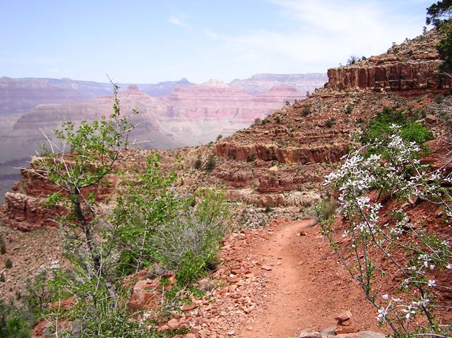
While the South Kaibab Trail follows a ridge line, the Bright Angel Trail follows the head of a side canyon. Views on the Bright Angel Trail are framed by massive cliffs, and by virtue of being a shadier trail with natural water sources, there is more plant life and animal life along the Bright Angel Trail than on the South Kaibab Trail. These features make the Bright Angel Trail appealing to those interested in geology and in viewing wildlife. The majority of this trail�s elevation change takes place in the upper four miles of trail via a series of switchbacks that can seem endless. Be sure to utilize the resthouses and seasonal water sources along the way. Whether ascending or descending, it is worthwhile to take breaks regularly. Approaching Indian Garden, the trail flattens out considerably as it crosses the shaley and desolate Tonto Platform. Indian Garden is an oasis in the canyon used by Native Americans up to modern times. Hikers camping at Indian Garden should consider the mile and a half side trip to Plateau Point. Below Indian Garden, the trail follows a creek through a meandering gully of water-sculpted stone and shimmering cottonwood trees. The trail becomes steep once again where this gully empties into the broad, bowl-shaped Pipe Creek drainage. This section of trail, referred to as the Devil�s Corkscrew, is brutally hot during the summer months and should therefore only be attempted during the early morning or late evening hours. There are no potable water sources between Indian Garden and Bright Angel Campground. A composting toilet is located near the River Resthouse. From the Pipe Creek/River Resthouse area to Bright Angel Campground, the trail traverses exposed sand dunes for over a mile until reaching the silver bridge across the Colorado River. Again, during hot weather, these sand dunes become a dangerous slog. Along the Bright Angel Trail, the only campgrounds are at Indian Garden (CIG) and Bright Angel Campground (CBG). At-large camping is not permitted on Corridor Trails; visitors must camp in designated campgrounds.
Cape Final
4 Miles RT


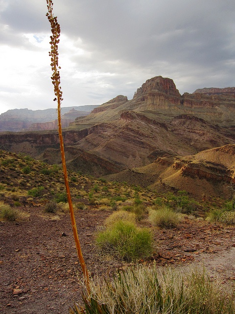
Located on the Walhalla Plateau at the Grand Canyon's North Rim. Access is from the Cape Royal Road, about 2.5 miles north of Cape Royal. Access to this part of the park by car is seasonal, traditionally open from mid-May to mid-October or depending on snowcover from the previous winter. The trail is only 2 mile long one-way and terminates at Cape Final at an elevation of 7,916 feet overlooking the eastern Grand Canyon from Nankoweap to the Unkar Creek Delta. Camping is allowed here with a valid permit obtained from the Backcountry Information Center, located just north of the North Rim Campground.
Cape Royal
1 Mile RT
3.5 miles north of the Grand Canyon Lodge at the North Rim is an intersection with Highway 67. The paved road bears east off of highway 67 and travels through the forest to the east for 6 miles to another intersection. Turn right at this intersection toward the Walhalla Plateau and Greenland Lake, Vista Encantada, Cape Final and Cape Royal. The 17 mile drive to the south from the intersection will afford several pullout viewpoints, a picnic area and near the Cape Royal parking lot is an Anasazi Dwelling that has been preserved. From the parking area, the trail heads south with signs describing the views and the local flora. Viewpoints along the trail include Angel's window (a natural arch), and Cape Royal itself at the end of the trail. The paved trail begins in the parking area at the southern end of Cape Royal Road on the north rim.
Clear Creek Trail
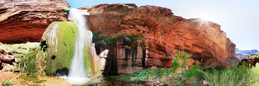
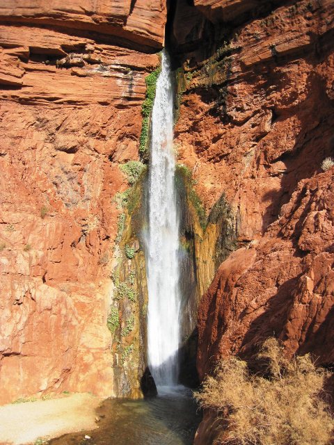
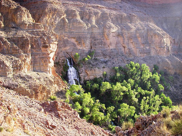
The trailhead is approximately � mile north of Phantom Ranch on the North Kaibab Trail. The junction is marked by a wooden sign. Clear Creek experiences highest visitation in March and April by hikers interested in seeing Cheyava Falls. From the junction with the North Kaibab Trail, the Clear Creek Trail climbs through a series of switchbacks to the southeast towards Phantom Overlook. After passing Phantom Overlook, the trail continues up to the base of the Tapeats and then traverses to the east for another mile to the Tonto Platform. While walking along the base of the Tapeats, hikers are exposed to the Great Unconformity, a gap in the geologic record spanning more than 1 billion years. After a final ascent to the top of the Tapeats, the trail contours along the Tonto Platform, crossing Sumner Wash and two minor drainages. The trail turns to the north when it intersects with Clear Creek drainage below Demaray Point. When Clear Creek Canyon appears on the right, hikers are still only half way to their destination. From here, the trail crosses shallow Zoroaster Canyon and then continues over an unnamed drainage to the north. Finally, at the end of the Tonto traverse, the trail drops into a drainage by traversing a long slope of orange-colored Hakatai Shale. The trail ends at a dry tributary creek bed, looking up this drainage one can see Brahma Temple. From here there is no trail, so it is necessary to hike down the drainage for approximately 150 meters to its confluence with Clear Creek. Most backpackers camp at the many impacted sites just downstream from the confluence. A faint route continues downstream to the confluence with the east fork of Clear Creek. Hiking to the Colorado River via the creek requires scrambling and numerous creek crossings. It is approximately six miles one way. A quarter mile from the river there is a pour off that requires a fifteen foot down climb. This climb can be wet and icy, so use extreme caution, and don't attempt if you don't feel comfortable with free climbing. Allow a full day to complete this hike. Many hikers also day hike up Clear Creek toward Cheyava Falls. This is a five mile hike one-way and follows the creek bed. Allow a full day to complete this hike. Cheyava Falls only flows in the spring after winters with high snow fall. The falls were first discovered in 1903 when a prospector saw what he thought might be a sheet of ice coating the cliffs up the northeast arm of Clear Creek drainage. The Kolb brothers, famous photographers who lived at Grand Canyon Village on the South Rim, caught wind of this and decided to investigate. They found a nearly 800 foot waterfall, Grand Canyon�s tallest.
Cliff Springs Trail
1 Mile RT
The trailhead is across the road from Angel�s Window Overlook, a paved pullout 19 miles up Cape Royal Road 0.5 miles north of the Cape Royal parking area. The trail curves around a boulder, then continues to descend through mixed forest into a rugged wash. Here the trail hugs the limestone cliffs, sheltered by a stony overhang high above. Water seeps from the base of the Kaibab limestone walls, converging at Cliff Spring�s shallow pools at the 0.5-mile point.
Grandview Trail


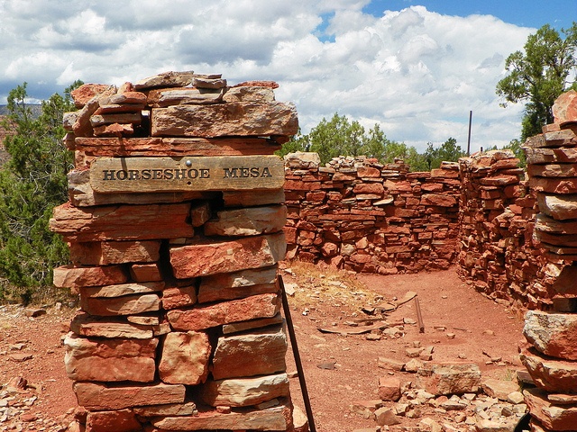
The trail begins at the north end of the Grandview Point parking area, off of Arizona state route 64, 12 miles east of Grand Canyon Village, Arizona. From the trailhead, it makes a quick descent through the Kaibab Limestone and Toroweap Formation, making a couple of early switchbacks. Portions of this section of trail were reconstructed in the summer of 2005 after a couple of storms washed them out. The trail generally follows the western side of the ridge that extends northeast of Grandview Point which marks a natural break in the Coconino Sandstone. The trail turns to the north and makes a final descent through the Hermit Shale and Supai Group until it reaches Horseshoe Mesa, 3 miles from the trailhead.
Camping is allowed on the mesa in designated areas on its eastern side and by permit only. Permits are issued by the Backcountry Information Center. Signage on the trail indicates the locations of the campsites. Composting toilets have been installed, but no water is available on the mesa.
The trail splits on Horseshoe Mesa near the Last Chance Mine. A spur trail leads east down a break in the Redwall Limestone on the eastern side of the mesa close to the rim. The spur trail is steep, leading past Miners Spring which is the nearest water source for camping on Horseshoe Mesa. The end of this spur is about 4.5 miles from the Grandview trailhead at a junction with the Tonto Trail and leads to the head of Hance Canyon, a perennial water source and alternate camping area. To the west of Last Chance Mine, a western spur from the Grandview Trail cuts through a break in the Redwall Limestone and descends the western side of the mesa following Cottonwood Creek. Water taken from this source must be filtered, treated, or boiled before consuming. The Grandview Trail follows the west side of a small butte that caps the mesa. It leads to the northern end of the mesa, and then descends between the two arms of the mesa to a junction with the Tonto Trail. From this point, the east branch doubles back toward Hance Canyon, and the west branch leads to Cottonwood Creek.
Hermit Trail
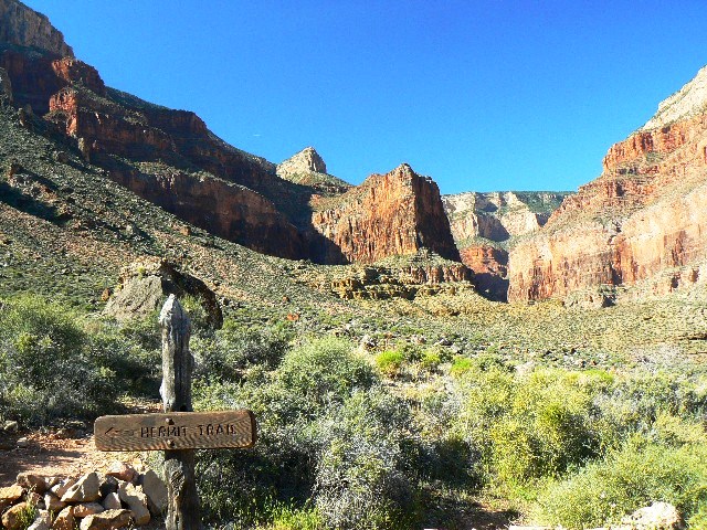
The trailhead is located on the South Rim. During spring, summer, and fall access is by shuttle bus, no private vehicles allowed. The trail begins 500 feet west of Hermits Rest. Hermit Trail day hikes are to Santa Maria Spring or Dripping Springs. Hermits Rest Route - This route operates from March 1 to November 30. Buses provide transportation between the Village Route Transfer and Hermits Rest with stops at nine canyon overlooks. During the return trip, buses stop only at Hermits Rest, Pima, Mohave, and Powell Points. Weather dependent, Hermit Road is open to private vehicles December 1 to February 28. Be aware that in wintertime inclement weather can cause Hermit Road to close temporarily with little notice as storms move through the area.
Horseshoe Mesa
6.4 Miles RT
From Flagstaff, take HWY 180 north towards the Grand Canyon. Once you enter the park, you'll head east on the East Rim Drive (Yaki point turnoff). About 9 miles on the East Rim Drive will get you to the Grandview Point. The parking area is a little less than a mile drive away.
Kanab Canyon Loop Trail

52.2 Miles RT
From Flagstaff drive north on Highway 89. Turn left on Highway 89A and drive to Jacob Lake. Head south on Highway 67 for 1/4 mile then turn right on Forest Road (FR) #461 towards the RV Campground. Continue west on FR #461 (stay to the left at the 4.5 mile point where FR #264 branches right) & stay straight 0.8 miles later when it intersects FR #462. Follow FR #462 11.8 miles to FR #22.
Preferred Route (shortest and easiest): Turn left (south) on FR #22 and drive 11.5 miles (~5 miles beyond Big Springs), then turn right (west) onto FR #425. Drive approximately 8 miles and turn right onto FR #233. Follow FR#233 9 miles to the trailhead & parking area, which is on the left.
Alternate Route (if the above is snowed in, these roads seem to accumulate less snow): Turn right (south) on FR #22. After 8.6 miles, turn right (west) onto FR #447 & drive 3.7 miles to the end. Turn left (south) onto FR #427 and follow it 7.2 miles to where it intersects FR #425 at a 'T' junction. Turn right (west) on FR #425 and follow it 1.7 miles and turn right onto FR #233. Follow FR#233 9 miles to the trailhead & parking area, which is on the left.
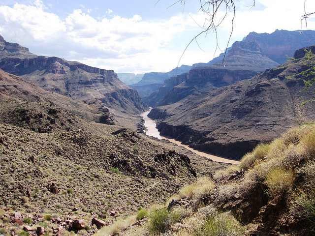
Kanab Canyon Loop Trail is a 52.8 mile loop trail located near North Rim, Arizona and is rated as difficult. The trail is primarily used for hiking and is accessible from March until November. This excellent loop trip goes through remote sections of the Grand Canyon. Highlights include the deep Redwall limestone gorges of Jumpup and Kanab Canyons, an enjoyable cross-country hike along the Colorado River, and Deer Creek Falls. There�s an optional side hike to Thunder River, which bursts suddenly out of a cave. Kanab Canyon features several side canyons with grottos and seasonal waterfalls, and one of the most unusual springs in the Grand Canyon.
Ken Patrick Trail
6 Miles RT
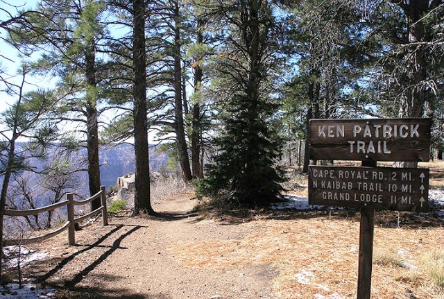
The trailhead for the Ken Patrick Trail is the same as that for the Uncle Jim Trail and both share the same parking lot with the trailhead for the North Kaibab Trail. This parking lot is about two miles north of Grand Canyon Lodge off of the main park road. The first mile or so of the Ken Patrick Trail and the Uncle Jim Trail are the same trail. The trail is pretty easy to follow up until the point where the Old Bright Angel Trail veers off to the south but beyond that can require careful navigation and possibly some route finding abilities.
From the parking area the trail heads northeast along the top of the Roaring Springs Drainage before it descends into that drainage and follows it for a short distance. About � mile after it leaves the drainage you will see a sign marking the junction with the Uncle Jim Trail. Two and a half miles beyond that you will reach the trailhead of the Old Bright Angel Trail. Beyond this point the trail becomes difficult if not impossible to follow, and from time to time it will simply disappear only to reappear later. Assuming you maintain the same basic northeasterly course and don't wander too far from the rim you should have no trouble in picking it up again. Don't be lead astray when you encounter the old park service roads or drainages leading into Bright Angel Canyon as the trail is not that easy to follow. Another portion of the trail that requires careful navigation is one where it is covered by a fair number of fallen trees. Once you make it to the Cape Royal Road you've got it made. From here the trail crosses the road and heads briefly back into the forest before bringing you right out to the rim. It then heads north along the rim of the Canyon, crosses the road a couple of times more, and presents an awesome spectacle along the remaining 4 miles or so that are left until you reach Point Imperial. Ken Patrick was a park ranger who was killed in the line of duty while working at Point Reyes National Seashore. He was killed by poachers in the 1970's and is buried at Grand Canyon.
Nankoweap Trail


The first access point for NFS trail #57 is located off of USFS road #610 in the Saddle Mountain Wilderness. To get in this way turn right off of AZ 67 onto USFS road #611, about a mile south of Kaibab Lodge or 4.5 miles north of the north rim entrance station. After about a mile road 611 joins with road 610 which in 13 more miles will bring you to the trail 57 trailhead.
The other access point for NFS trail #57 is through House Rock Valley along USFS road #445. To get in via this route turn off of US-89A onto USFS road #1049, about 20 miles east of Jacob Lake or 20 miles southwest of Marble Canyon. Follow road #1049 until it becomes road #445 which will take you to the other trail 57 trailhead.
The Nankoweap trail descends 6,040 feet in 14 miles from the Saddle Mountain trailhead to Nankoweap Creek and on to the Colorado River. It is considered to be the hardest of the trails into the Canyon. Hikers have to carry and cache water as there is none in the 11 miles between the trailhead and Nankoweap Creek. "The Scary Part" is a section that is 6 inches wide under a sheer cliff with a couple of hundred foot drop punishing the slightest misstep. Getting across "The Scary Part" with a full pack is a serious challenge.
New Hanse Trail
13 Miles RT
The trail begins 16 miles east of the junction of Desert View Drive and the South Entrance Road. Park at Moran Point and walk west, or park at the first pullout east of the Buggeln picnic area. This pullout is on the south side of the road and from here walk east, to the "No Parking" sign which marks the � mile path that will take you to the trailhead . The New Hance Trail (a.k.a. Red Canyon Trail) is considered one of the most difficult trails on the South Rim. There is no parking available at the trailhead, which is located about 5 minutes on foot north of the South Rim main road. The trail ends at the Hance Rapids on the Colorado River. This trail has become used more in recent years. It is no longer only marked by the occasional cairn. While it is a very rugged trail, it is now a real single track trail that is very distinct and relatively easy to follow the entire way from the South Rim Drive to the river. Well-engineered switchbacks and other trail maintenance clearly indicate that significant work, however irregularly, has been done on the trail over the years since John Hance 1st created the trail in the 1890s. The top 1 mile is the steepest and most rugged with hard switchbacks down a steep slope and many big steps, 2�4 feet high, to carefully negotiate. Below the top 1 mile, the big steps become fewer and farther apart and the trail is less steep. However, occasional steep stretches and big steps are found the entire length of the trail. There are a couple of isolated spots in the bottom wider areas of Red Canyon where the trail splits into multiple paths but they eventually converge again after a short distance.
North Bass Trail
27 Miles RT
The trail is accessible by use of U.S. Forest Service roads along the north rim of Grand Canyon. The trailhead is located in the remote backcountry of the forests on the canyon's the north rim. To reach it, an 18-mile drive by high-clearance (4-wheel drive preferred) vehicles is required. The trail begins at Swamp Point at an elevation of 7,500 feet at the end of Swamp Point Road.
This trail is considered difficult, primarily due to length and elevation. A major reconstruction effort by a volunteer crew in 2005 restored much of the original trail bed, improving travel and navigation, but still one of the Canyon's most strenuous trails and providing access to an exceptional wilderness area.
North Kaibab Trail
Supai Tunnel 6 Miles RT
The trailhead is located 41 miles south of Jacob Lake on Highway 67 (1.5 miles north of Grand Canyon Lodge). A small parking area offers limited parking. Transportation is available from the Grand Canyon Lodge (twice each morning; check at the lodge for times and fares) or, for those staying at North Rim Campground, it is a half-mile walk to the trailhead. Hikers on a rim-to-rim hike and who have only one vehicle often use the private Trans-Canyon Shuttle (928-638-2820), which provides service between the North Rim (departs around 6 a.m.) and the South Rim (departs around 1 p.m.) daily from May 15 to October 15. North Rim park facilities (lodge, store, gas station) close on October 15, but Highway 67 remains open to vehicle traffic until winter conditions preclude access. Visitors should be prepared for road closure anytime after October 15, but often Highway 67 remains open into November. Once closed Highway 67 remains so until May 15. It is not possible to reach the trailhead by vehicle before May 15.
Resembling the Bright Angel Trail more than the South Kaibab Trail, the North Kaibab initially descends steeply down the head of a valley via a series of numerous switchbacks. The trail reaches the distinctive Supai Tunnel, where hikers will find potable water (mid-May to mid-October) and pit toilets, but no emergency phone. Where the bulk of the trail's descent meets the flatter bottom of Bright Angel Canyon, Roaring Springs is a worthwhile side trip. Here, water gushes forth directly out of the cliffs, cascading over moss and fern to form Bright Angel Creek. This giant spring provides drinking water for every visitor and resident within Grand Canyon National Park. The water is delivered to the South Rim via a pipeline buried beneath the North Kaibab Trail (installed 1965-1970). You can see this amazing pipeline as it stretches across the Colorado River on the underside of the Bright Angel Trail's Silver Bridge.
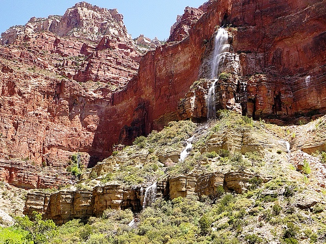
At mile 5.4 an unexpected house comes into view. The Pumphouse Residence, also known as the Aiken Residence, is where artist and park employee Bruce Aiken lived and painted for decades. In years past the lucky hiker could get a refreshing cup of lemonade from one of the Aiken kids who were raised at the bottom of the Grand Canyon. Passing the Pumphouse Residence is a welcome sign for the descending backpacker for it signals the approach of Cottonwood Campground. Those fortunate to overnight at Cottonwood Campground will have the time to explore a beautiful oasis located 1.6 miles down-creek from the campground: Ribbon Falls is a true gem of the North Kaibab Trail. The waterfall is located in a grotto on the west side of Bright Angel Creek, so reaching it is a short but extremely rewarding side trip.
Between Cottonwood Campground and Bright Angel Campground the trail enters the Inner Gorge, a narrow canyon within the canyon where the trail is boxed in on either side by 1.7 billion year old Vishnu Schist. Though the trail here is not challenging from the perspective of elevation profile, be aware that this is a particularly dangerous stretch of trail during summer months. Because the entire 7.2 mile stretch is at low elevation, it becomes extremely hot from early morning to late afternoon. The gorge of black rock through which the trail passes becomes like an oven and can be compared to walking through a parking lot in Phoenix or Las Vegas in summertime. Always plan on reaching Bright Angel Campground before ten in the morning.
Powell Plateau
From Jacob Lake, go 26.5 miles on AZ 67 S; turn right onto FR 22, left onto FR 270, then right onto FR 223. Go 5.8 miles, then veer left onto FR 268 and left again onto FR 268B into park. Go 7.8 miles to Swamp Point Trailhead. High-clearance vehicles only. This is a remote hike that rises a mile above the Colorado River near the canyon�s North Rim. It�s only 2.5 miles from the trailhead to the plateau, but you�ll want to spend at least 2 days exploring the 10 miles of secluded trail along the rim. Start by switchbacking down 1 mile and 800 feet from Swamp Point trailhead to an unsigned junction at Muav Saddle. Continue straight and descend to a slightly lower saddle, then climb 900 feet over 1.5 miles to reach the plateau. (The trail is faint in places.) When you reach the rim, follow the trail south for one magnificent view after another.
Rim Trail
26 Miles RT


The trail begins from any viewpoint in Grand Canyon Village or along Hermit Road. You can access the trail from many of the shuttle bus stops. The Rim Trail stretches from the South Kaibab Trailhead west to Hermits Rest, most of the trail is paved. Between Pipe Creek Vista and Bright Angel Lodge only a few short sections of the trail have grades that exceed accessibility standards. West of Bright Angel Lodge, the Rim Trail narrows and climbs the Bright Angel Fault to viewpoints along Hermit Road. Between Powell Point and Monument Creek Vista the trail is a three foot wide dirt trail. The section of the Rim Trail between Monument Creek Vista and Hermits Rest is also known as the Hermit Road Greenway Trail.
Shoshone Point

2 Miles RT


Drive east from Grand Canyon Village on Desert View Drive. Soon you�ll pass the paved road to the left that goes to the South Kaibab Trailhead and Yaki Point. You�ll also pass a nearby road sign that warns of mountain lions crossing the road. About a mile after this point you�ll see a gated dirt road to the left, with a small dirt lot in front of it. This is the parking for Shoshone Point. Walk the dirt road for a little over a mile beyond the gate and you�ll come to the viewpoint. Shoshone Point has some of the best views among the overlooks at the South Rim of the Grand Canyon. It�s over a mile�s walk from the nearest public parking, and is significantly less crowded.
South Bass Trail
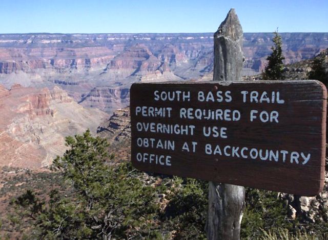
During the fall, winter and spring months drive out Hermit Road one quarter mile then turn left onto Rowe Well Road. During the summer months the Hermit Road is closed. Turn left at the West Rim interchange and drive south to the Maswik Lodge. Near the lodge a sign will direct you to the kennels. Follow the signs until you cross the railroad tracks and reach Rowe Well Road. Follow Rowe Well Road south, passing the kennels. After leaving the park in about 2.5 miles, the road turns to the east and climbs a steep hill across the railroad tracks. It joins Forest Service road #605. Turn right and cross the tracks again. Here a sign points the way to Forest Road #328, a right turn up a slope. The road that proceeds straight ahead at this point is equally passable. Once on FS road #328, follow it west about 6 miles to a junction just north of Little Rain Tank and several ranch buildings. At this junction you will see a sign marked "Topacoba Hilltop". Turn right here and continue on FS #328 passing Sheep Tank, Homestead Tank, Cecil Dodd Tank, and on into the Havasupai Indian Reservation. In wet weather many travelers become stuck at Cecil Dodd Tank. Once inside the reservation, continue 1.5 miles to a road junction. Turn right, cross two cattle guards and continue on to the Pasture Wash Ranger Station and the South Bass Trailhead. About two miles before Pasture Wash, you will re-enter the National Park. From the Pasture Wash Ranger Station to the South Bass Trailhead the road is very narrow and deeply rutted. You may prefer to park your vehicle at the station and walk the 3.6 miles to the trailhead. Forest Road #328. Most of the road is rough and is impassable during wet weather conditions. During dry weather conditions a high clearance, four wheel drive vehicle is recommended.
The trail passes an old fence and follows the rim of the Coconino a short distance north before starting down rocky switchbacks to the Esplanade platform at the top of the Supai Formation. The Royal Arch Route leaves the South Bass Trail and starts west where the trail comes to the Esplanade, the junction marked with a large cairn. Stay right at this intersection and follow the South Bass Trail north across the terrace east of Mount Huethawali. The route traverses near the Supai rim for about a mile to a steep break that allows passage to the slopes below. Dropping below the Esplanade, the trail rounds a promontory and descends Supai ledges south toward the bed of Bass Canyon. Once established in the drainage the route follows the bottom of Bass Canyon through the Redwall. The path leaves the drainage and descends most of the Tonto Group rocks via the slopes east of and above the bed of Bass Canyon, eventually returning to the bottom of the canyon just above the Tonto Trail junction. The Tonto Trail is marked by large cairns. Below Tonto Trail the South Bass Trail continues down Bass Canyon, crossing and re-crossing the drainage as it winds around various obstructions. This section can be confusing, but the trail stays as close to the bed of the canyon as the terrain allows, so any disorientation shouldn't last long. An impassable rock fall blocks access to the river at the mouth of Bass Canyon. Watch where the trail leaves the bed of the drainage, going west a short distance to a large cairn marking a shortcut that allows passage down a rocky ravine to the river below. The ravine route can be tedious and this shortcut may be bypassed by continuing another couple minutes west until a gentler path descends to the river opposite a historic fire place.
South Canyon
26 Miles RT
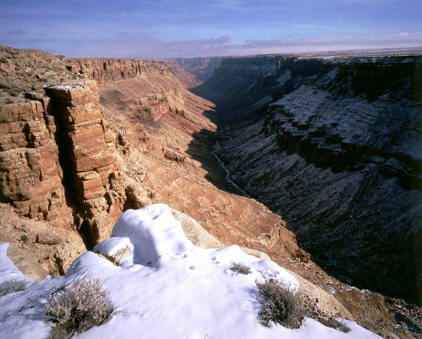
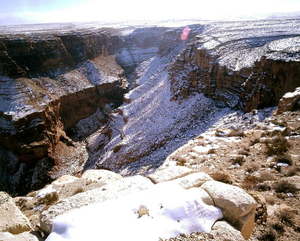
The Canyon is located in the far southern corner of Marble Canyon, about 35 miles south of Lee's Ferry, which is the starting point of Grand Canyon National Park. Lee's Ferry is 15.3 miles down the river from the Glen Canyon Dam. Marble Canyon ends where the Colorado River meets the Little Colorado River. South Canyon is usually dry, but if hiking after heavy rain or snow melt, clear water may flow over smooth polished rock of the creek bed. The mileage to the river from the canyon bottom is measured at a little less than 6 miles but with all the maneuvering around obstacles the route is much longer and time consuming. South Canyon is strewn with large boulders, tamarisks and sagebrush. Hike down the wash for about an hour, noting the limestone alcove on the left. Continue down the wash and the sandy bottom changes to hard rock.
South Kaibab Trail
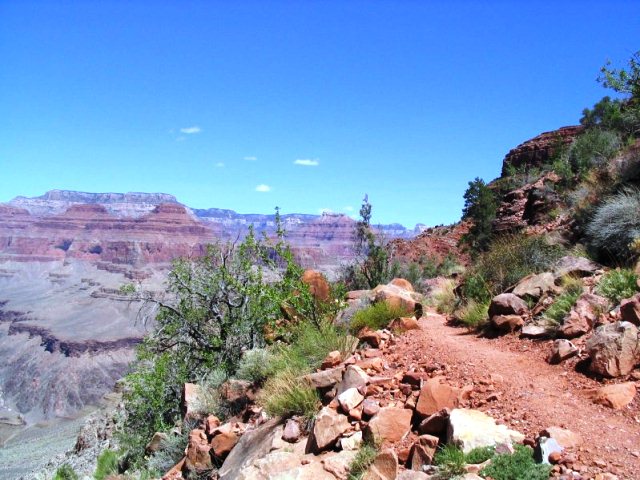
The trailhead for the South Kaibab Trail is located off of the Yaki Point Road, which is closed to private vehicles. The trailhead can be accessed via either the Rim Trail or the free Grand Canyon National Park shuttle bus. From the trailhead, the trail heads north. Hikers begin with a steep descent through the Grand Canyon's upper rock layers: the Kaibab Limestone and Toroweap Formation. Through the first � mile, the trail cuts through the eastern side of Pipe Creek Canyon until Ooh-ahh Point, where the canyon walls turn around Yaki Point and the view of the eastern canyon opens up. From Ooh-ahh Point the trail turns around a few switchbacks in a natural break in the Coconino Sandstone until Cedar Ridge, where the trail begins to level off slightly. Cedar Ridge has toilet facilities and offers a place for hikers and mule trains to rest. Below here, the trail continues north around the east site of O'Neill Butte, descending gradually through the Hermit Shale and Supai Group to Skeleton Point, three miles from the trailhead. After Skeleton Point, the trail begins a sharp descent through a natural break in the Redwall Limestone. The trail cuts to the west of the point where hikers can get a view of Phantom Ranch, then quickly back to the east side of the point. There are numerous switchbacks to descend the 1,200 feet to the junction with the Tonto Trail, 4� miles from the trailhead. A sign marks the trail junction, which has toilet facilities. The Tonto Trail heads west towards Indian Garden, and east towards Horseshoe Mesa and Hance Rapids. About � past the junction is a point called the Tipoff, where an emergency phone is located on the east side of the trail. After the Tipoff the trail makes its final steep descent to the bottom of the canyon. Six miles from the trailhead, there is a junction with the River Trail at its eastern terminus. One-half mile past the junction, there is a tunnel that leads to the Black Suspension Bridge crossing the Colorado River. Mule trips from the south rim cross this bridge except when it is closed to traffic. The other crossing of the Colorado is about � downstream on the Silver Suspension Bridge, accessible from the River Trail. On the north site of the river the trail turns westward and descends slightly. There is a spur that leads to Boat Beach on the Colorado River, just downstream from the black bridge. About � mile past the bridge is the junction with the River Trail and North Kaibab Trail, marking the official end on the South Kaibab Trail seven miles from the trailhead. There is a restroom and water spigot at the junction. The Bright Angel Campground is located just past here, and Phantom Ranch is about � mile past the campground.
The South Kaibab Trail is also part of the Arizona Trail system, crossing the state of Arizona from Mexico to Utah.[2] The thru-trail continues north from here along the North Kaibab Trail. Hikers may only camp at the Bright Angel Campground, where they can stay overnight with a permit issued by the Grand Canyon National Park Backcountry Information Center. Wood and charcoal fires are not permitted; camp stoves only.
Tanner Trail

The trailhead is located at Lipan Point, a prominent lookout located to the east of the Grand Canyon Village and it ends at the Colorado River at Tanner Rapids. The Tanner trailhead begins at the information sign just before Lipan Point. The trail starts out by crossing the rim plateau to the canyon edge. It then enters the Tanner Canyon and starts a series of switchbacks, which become very steep and rocky. The descent is considered to be one of the steepest rim descents in the Grand Canyon. The trail goes through the Kaibab Formation and becomes even steeper in the Coconino sandstone and the Hermit shale. It finally reaches the Supai group, where the ridge between Tanner Canyon and Seventy five Mile Canyon is located. The trail then enters into the Tanner Canyon creek for a short time then leaves the creek. It then makes a long yet moderate crossing of the Supai group. There are many suitable campsites along this stretch, while it passes Escalante and then Cardenas Buttes. The trail passes below these buttes and descends into a boulder-strewn plateau. It then turns to the north to the end of the plateau. At this point the trail makes its second major descent, dropping off the plateau into the lower Tanner Canyon. There are some switchbacks yet the trail mainly descends straight down around 800 ft to a red saddle. From the saddle, the trail levels out, although there is still a gradual rate of descent. The trail follows the west side of Tanner Canyon, slowly descending to the streambed below. When the streambed is reached, the trail crosses over to the east side and up onto the river plateau. It crosses this small plateau and drops into the campground.
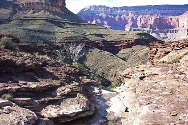
Thunder River Trail
26 Miles RT

The trailhead for the Thunder River Trail is located at Indian Hollow. To get to Indian Hollow use the same directions for getting to the Bill Hall Trail at Monument Point. Just remember to keep following the signs for Thunder River and take the right turn around mile 29.5. From the trailhead at Indian Hollow the trail heads west along the rim for a little more than a � mile. Once it reaches the Esplanade it begins to work its way eastward for 4 miles until it joins up with the Bill Hall Trail. Before reaching the Bill Hall trail it will take you on a little side trip around the Deer Creek drainage which is just north of the Bill Hall trail junction. The Thunder River Trail was originally constructed in 1876 when rumors of a gold find along the Colorado River required some type of access route to the Deer Creek area. The current trail which goes down to Thunder River and Tapeats creek was not constructed until 1926. Thunder River is the world's shortest and probably steepest river. It runs only � mile from Thunder Cave to its confluence with Tapeats Creek and over this short course it drops some 1200 feet.
Tonto Trail


Tonto trail crosses the South Bass Trail, Boucher Trail, Hermit Trail, Bright Angel Trail, South Kaibab Trail and the New Hance Trail. The Grandview Trail is also accessible via its eastern and western spurs. All of the connecting trails provide access to and from the Grand Canyon south rim, while the Bright Angel Trail and South Kaibab Trail both provide access to the Colorado River, and the north rim via the North Kaibab Trail. At Garnet Canyon, the Tonto Trail officially ends, but a trail continues along the Colorado River to Elves Chasm. There is also a junction with the Royal Arch Route, which requires a rappel from to access the river trail. At Red Canyon, the eastern end of the Tonto Trail, the Escalante Route continues eastward, connecting to the Tanner Trail and Beamer Trail at Unkar Creek. There is additional access to the Colorado River in Monument Canyon via a 1� mile spur trail that leads to Granite Rapids. There is a designated campsite at the river. There is also access to the river via all trails that cross the Tonto, except the Grandview Trail. Camping is allowed along the Tonto Trail by permit only, issued by the Grand Canyon National Park Backcountry Information Center.
Transept Trail
3 Miles RT


The Transept trail is located in the North Rim Section of the Grand Canyon National Park. The trail follows the canyon rim connecting the Visitor Center and Grand Canyon Lodge with the North Rim Campground. The Transept Trail is an up-and-down meander through a ponderosa pine forest that gives way to Gambel oaks along the rim of Transept Canyon. Stop midway, where a couple of rows of benches offer views of Zoroaster, Brahma, and Deva Temples. Nearby, small Native American ruins, 1,000 years old, stand next to the trail. Return the same way, or make a loop by taking the Bridle Path that parallels Highway 67 between the lodge and the campground.
Uncle Jim Trail
5 Miles RT


From the north entrance to Grand Canyon National Park go 10 miles south on AZ 67 to the Kaibab Trailhead. To get to the Uncle Jim Trail, you must first hike a mile on the Ken Patrick Trail. The Ken Patrick Trail is also used as a mule trail, so the entire length of the trail you are dodging mule-piss puddles and piles of donkey dung. In some areas there is a hiker trail a few feet above the formal one so you can utilize that to preserve your boots and your nose. The Ken Patrick Trail itself, follows along the edge of the canyon rim, with some nice views. After one mile you reach the junction with the Uncle Jim Trail. The trail drops moderately for 0.5 miles to a drainage and then climbs back out, switch backing along the way. Near the top of the climb, you reach an unsigned junction that is the start of the loop. You can go either direction. To the right the trail flattens out as it crosses through the center of the peninsula leading to Uncle Jim Point. The trail ends at the junction with the other half of the loop at Uncle Jim Point. You can see the Kaibab trail switchbacks, Bright Angel Point and Roaring Springs Canyon.
Widforss Trail
10 Miles RT


To get to the trailhead take the dirt road that begins about � mile south of the road that takes you out to Point Imperial and Cape Royal, or one mile north of the North Rim Campground, across from the parking lot for the North Kaibab Trail, off of the main park road. The parking area and trailhead are about one mile in on this road.
From the parking area the trail leads you to the southwest across the northern end of The Transept. The trail is very easy to follow all the way out to Widforss Point with only some minor dips and rises as it passes through some of the northeastern drainages of Transept Canyon. The first three miles or so of the trail follow right along the rim of The Transept, crosses a few drainages, and then turns south into the forest. About two miles more you will reach Widforss Point overlooking the head of Haunted Canyon. The creek that flows down Haunted Canyon eventually joins with Phantom Creek which eventually joins Bright Angel Creek just north of Phantom Ranch.
