|
|
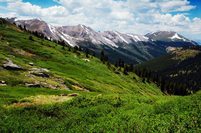
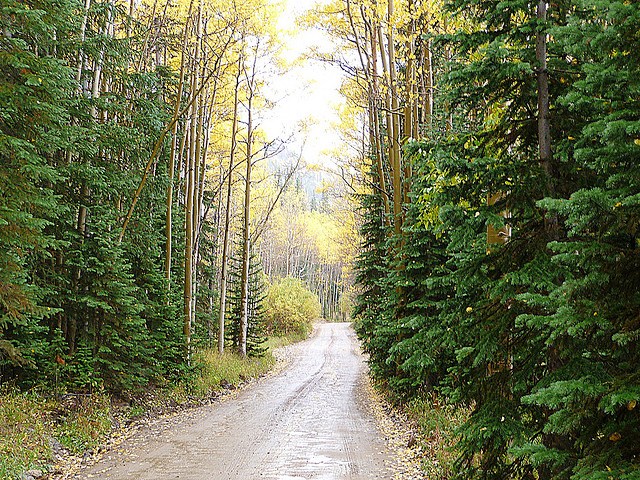
Alpine Tunnel Road
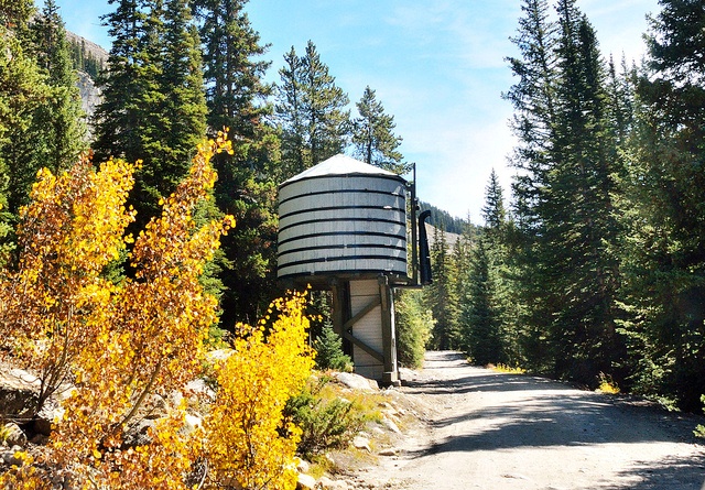 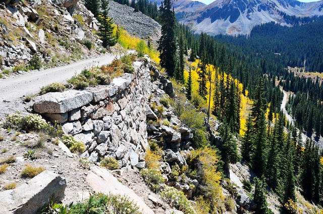 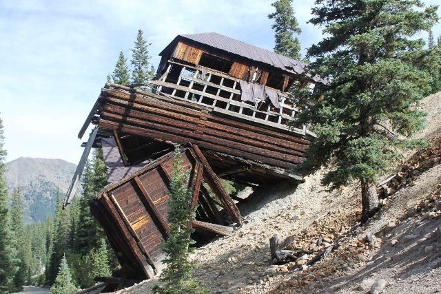 The road is in good condition and is considered an "easy" drive, at least until you near the top. Next to spectacular cliffs, the road crosses a narrow man-made terrace known as the "Palisades." The ledge is supported by a wall of hand cut native stones, two feet thick by 33 feet high and 425 feet long. The entire wall was dry laid without the use of mortar. A tribute to its talented builders, the wall remains today in the same relative condition as when first constructed in 1881. The Alpine Tunnel Historic District consists of a two hundred foot wide right of way along thirteen miles of original Denver, South Park and Pacific railbed between the town sites of Quartz and Hancock. The District consists of property located on the Gunnison National Forest and the San Isabel National Forest as well as two separate parcels of private land. The Alpine Tunnel Historic District is a joint Project sponsored by the Gunnison County Lodging Tax Panel, the Alpine Tunnel Historic Association, and the U.S. Forest Service. The Alpine Tunnel Historical District is normally open from July to September. Visitors to the District can follow a 10 mile auto tour. The auto tour begins northeast of Pitkin at the junction of the Cumberland Pass Road (FDR 765) and the Alpine Tunnel Road (FDR 839). The road is in good condition and is considered an "easy" drive, at least until you near the top. Next to spectacular cliffs, the road crosses a narrow man-made terrace known as the "Palisades." The ledge is supported by a wall of hand cut native stones, two feet thick by 33 feet high and 425 feet long. The entire wall was dry laid without the use of mortar. A tribute to its talented builders, the wall remains today in the same relative condition as when first constructed in 1881. The Alpine Tunnel Historic District consists of a two hundred foot wide right of way along thirteen miles of original Denver, South Park and Pacific railbed between the town sites of Quartz and Hancock. The District consists of property located on the Gunnison National Forest and the San Isabel National Forest as well as two separate parcels of private land. The Alpine Tunnel Historic District is a joint Project sponsored by the Gunnison County Lodging Tax Panel, the Alpine Tunnel Historic Association, and the U.S. Forest Service. The Alpine Tunnel Historical District is normally open from July to September. Visitors to the District can follow a 10 mile auto tour. The auto tour begins northeast of Pitkin at the junction of the Cumberland Pass Road (FDR 765) and the Alpine Tunnel Road (FDR 839).
Animas River
  
Animas River is 126-Mile-Long, and a tributary of the San Juan River, part of the Colorado System. The Durango & Silverton Narrow Gauge Railroad runs along the river pretty much the entire time between the two cities. This is a beautiful ride and I would highly recommend this for everyone to experience.
Baldwin Lakes Trail
3.4 Miles RT
   From Denver, take Highway 285 south to just past Nathrop. Chaffee County Road 162 goes west from Highway 285 toward the Chalk Cliffs and Mount Princeton Hot Springs. After crossing Baldwin Creek (marked with a sign) you will see the sign to Mount Antero. Take the Mount Antero trail for 2.7 miles to the trailhead on the right. From Denver, take Highway 285 south to just past Nathrop. Chaffee County Road 162 goes west from Highway 285 toward the Chalk Cliffs and Mount Princeton Hot Springs. After crossing Baldwin Creek (marked with a sign) you will see the sign to Mount Antero. Take the Mount Antero trail for 2.7 miles to the trailhead on the right.
This is one of the more challenging trails out of all of the trails in the area. It begins by the creek just off of the county road, and it ends at an old mine shaft and an old collapsed building about a mile west of the lakes. You will need a high-clearance vehicle, because at the top there are a lot of large rocks that make the trail quite challenging. The start of the Baldwin Lake trail is located where you cross the creek near the start of the Mount Antero trail. Instead of going across the creek to continue up to Mount Antero you keep going straight to take the Baldwin Lake trail. After the first small hill climb, there is a big camping area by Baldwin Creek. At this point, the trail gets a lot steeper. You will also find big rocks on the trail for another mile or so. Then, the trail becomes a short but narrow shelf road. At the end of the shelf road, you can take a right turn to go to the Boulder Mountain trail. Continue to the left to stay on the Baldwin Lake trail. Soon you will be by the first of the Baldwin Lakes. There are some camping sites around this area. At the far side of the lake, you will see a road that is closed to vehicular traffic. You can hike the closed road to the upper Baldwin Lake. The rest of the Baldwin Lake trail becomes more difficult just before the end of the trail due to its increased roughness and bigger rocks to negotiate. For the most part, there is only one line you can take to stay on the trail. At the end you will find the Baldwin Mine. At this point, you must turn around and go back the way you came.
Barr Lake

   From Denver head north on I-76 to Bromley Lane. East on Bromley Lane to Picadilly Raod, then south on Picadilly Road to the Barr Lake State Park entrance. Barr Lake State Park is a Colorado State Park established in 1977. The 2,715-acre park has 12 miles of trails, including an 8.8 miles trail that circles Barr Lake. Fishing and boating are allowed in the northern half of the park. The southern half is a wildlife refuge, with several wildlife viewing stations and a nature center. Numerous Bald Eagles spend the winter at Barr Lake and one pair nests every year. The park is popular with birders, over 300 species have been observed. The headquarters of the Rocky Mountain Bird Observatory is inside the park on the west side of the lake. From Denver head north on I-76 to Bromley Lane. East on Bromley Lane to Picadilly Raod, then south on Picadilly Road to the Barr Lake State Park entrance. Barr Lake State Park is a Colorado State Park established in 1977. The 2,715-acre park has 12 miles of trails, including an 8.8 miles trail that circles Barr Lake. Fishing and boating are allowed in the northern half of the park. The southern half is a wildlife refuge, with several wildlife viewing stations and a nature center. Numerous Bald Eagles spend the winter at Barr Lake and one pair nests every year. The park is popular with birders, over 300 species have been observed. The headquarters of the Rocky Mountain Bird Observatory is inside the park on the west side of the lake.
Big Bluestem Loop/Mesa/South Boulder Creek Trail
4.35 Miles RT
   The South Boulder Creek Trailhead is located on Highway 93 in south Boulder 2.0 miles south of the Highway 93 and Table Mesa Drive intersection on the west side of the road. The South Boulder Creek, Mesa and Big Bluestem trails form a mild loop through open space between the eastern plains and Boulder foothills. Multiple trail connections and extensions offer additional routing options of varying length and difficulty along or up into the foothills. The South Boulder Creek Trail heads southwest on a wide groomed path until bending west, narrowing and rising more assertively on rocky single track. Bear right on the Mesa Trail and quickly off onto the Big Bluestem Trail, which undulates north to the base of a steep mesa and splits into upper and lower segments. Bear right on the Lower Big Bluestem Trail. The Lower Big Bluestem skirts the mesa base, curls northeast and back down through vast open space. Continue past an unmarked spur - the Shanahan Ridge Connector and pass through a final gate where the trail becomes a residential street leading to the north side of the South Boulder Creek Trailhead parking lot. The South Boulder Creek Trailhead is located on Highway 93 in south Boulder 2.0 miles south of the Highway 93 and Table Mesa Drive intersection on the west side of the road. The South Boulder Creek, Mesa and Big Bluestem trails form a mild loop through open space between the eastern plains and Boulder foothills. Multiple trail connections and extensions offer additional routing options of varying length and difficulty along or up into the foothills. The South Boulder Creek Trail heads southwest on a wide groomed path until bending west, narrowing and rising more assertively on rocky single track. Bear right on the Mesa Trail and quickly off onto the Big Bluestem Trail, which undulates north to the base of a steep mesa and splits into upper and lower segments. Bear right on the Lower Big Bluestem Trail. The Lower Big Bluestem skirts the mesa base, curls northeast and back down through vast open space. Continue past an unmarked spur - the Shanahan Ridge Connector and pass through a final gate where the trail becomes a residential street leading to the north side of the South Boulder Creek Trailhead parking lot.
Blackmer Loop-Cheyenne Mountain State Park
  Drive south on Colorado Highway 115. Turn right across from the main entrance to Fort Carson. Follow signs to the state park's day-use trailhead parking area. You'll take adjacent trails to get to Blackmer Loop. However, from the day-use parking lot the main trailhead is the same. Set out from the west side of the lot. You'll hit a short portion of Zook Loop and then turn north when signs point to Coyote Run and Boulder Run. After � mile you'll pass a picnic area and climb a bit toward camp sites and cabins. Cross a road and pick up Boulder Run on the opposite side. In about a � mile you'll hit Blackmer Loop. To cut the hike short, turn south and pick up Medicine Wheel or Zook Loop back to the parking lot. These trails are well-marked. If you're hiking the full Blackmer Loop you can add nearly a mile taking Cougars Shadow. As with the shorter hike, you'll take Medicine Wheel or Zook Loop to return to the trailhead. Drive south on Colorado Highway 115. Turn right across from the main entrance to Fort Carson. Follow signs to the state park's day-use trailhead parking area. You'll take adjacent trails to get to Blackmer Loop. However, from the day-use parking lot the main trailhead is the same. Set out from the west side of the lot. You'll hit a short portion of Zook Loop and then turn north when signs point to Coyote Run and Boulder Run. After � mile you'll pass a picnic area and climb a bit toward camp sites and cabins. Cross a road and pick up Boulder Run on the opposite side. In about a � mile you'll hit Blackmer Loop. To cut the hike short, turn south and pick up Medicine Wheel or Zook Loop back to the parking lot. These trails are well-marked. If you're hiking the full Blackmer Loop you can add nearly a mile taking Cougars Shadow. As with the shorter hike, you'll take Medicine Wheel or Zook Loop to return to the trailhead.
Blue Mesa Reservoir
The reservoir is located in the Curecanti National Reacreation Area, in Western Colorado, between Montrose and Gunnison. It is one of the three reservoirs formed from the Gunnison River. Blue Mesa Reservoir is the largest body of water entirley in Colorado at 20 miles long with 96 miles of shoreline.
Boreas Pass Trail
   From the town of Breckenridge, drive to the south side of town. Near the Conoco station, turn East onto the Boreas Pass Road. Drive 3.5 miles to a parking area where the road turns to dirt. This is the site of the Winter closure. The Boreas Pass Road closes the first Monday of November, and re-opens in mid to late Spring. If the gate is open, you can drive 6 more miles to the summit of Boreas Pass. This dirt road is well maintained, and is accessible by 2WD vehicles when it is dry. If the road is wet or snowy, you will want 4WD. From the summit of Boreas Pass, hike past the huts and aim for the ridge between Boreas Mountain and Bald Mountain. You should be able to see Point 12,815 from the road. After you bypass Point 12,815, the rest of the route will be visible ahead of you. Boreas Mountain has an odd-looking trough on its summit. Enter the trough on use trails. The best trail skirts the right side of the trough. Continue until you can see the actual summit ridge, which only becomes visible once you are halfway up the trough. Gain the summit ridge and walk to the summit. From the town of Breckenridge, drive to the south side of town. Near the Conoco station, turn East onto the Boreas Pass Road. Drive 3.5 miles to a parking area where the road turns to dirt. This is the site of the Winter closure. The Boreas Pass Road closes the first Monday of November, and re-opens in mid to late Spring. If the gate is open, you can drive 6 more miles to the summit of Boreas Pass. This dirt road is well maintained, and is accessible by 2WD vehicles when it is dry. If the road is wet or snowy, you will want 4WD. From the summit of Boreas Pass, hike past the huts and aim for the ridge between Boreas Mountain and Bald Mountain. You should be able to see Point 12,815 from the road. After you bypass Point 12,815, the rest of the route will be visible ahead of you. Boreas Mountain has an odd-looking trough on its summit. Enter the trough on use trails. The best trail skirts the right side of the trough. Continue until you can see the actual summit ridge, which only becomes visible once you are halfway up the trough. Gain the summit ridge and walk to the summit.
Box Canyon Falls Park
Take HWY-550 south of Ouray and turn right on the County Road 361. Signs point across the Uncompahgre Gorge to the Visitor's Center parking lot. There are three interpretive trails in the park that range from easy to moderatley difficult with numerous picnic sites. The Falls Trail is an easy, mostly level, 500 foot walk into the canyon. The High Bridge Trail is a steep 200 foot climb, half mile RT hike. The Native Plant Loop is a short, easy stroll.
Breakneck Pass and Browns Pass Trail
  From Fairplay, Colorado (south of Breckenridge on Hwy 9) take Hwy 285 south to a sign marking CR5 and Weston Pass. Take this road west for about a mile till a sign on the right marking Breakneck Pass. This marks the beginning of the trail. To run the route in the opposite direction, you would take the turn for CR20 off of 285. This turn is about a mile north of the turn for CR5 & Weston Pass. From Fairplay, Colorado (south of Breckenridge on Hwy 9) take Hwy 285 south to a sign marking CR5 and Weston Pass. Take this road west for about a mile till a sign on the right marking Breakneck Pass. This marks the beginning of the trail. To run the route in the opposite direction, you would take the turn for CR20 off of 285. This turn is about a mile north of the turn for CR5 & Weston Pass.
Fairly easy 4WD trail that travels under the canopy of the dense forest; Aspen viewing in the fall. High-clearance 4WDs are preferred, but any high-clearance vehicle is acceptable. Expect a rough road surface; mud and sand are possible but will be easily passable. You may encounter rocks up to 6 inches in diameter, a loose road surface, and shelf roads, though these will be wide enough for passing or will have adequate pull-offs.
Browns Lake Trail
  Take Highway 287 north from Fort Collins to Highway 14. Travel west on Highway 14 for 25 miles to the Pinegree Park Road. Take the Pingree Park Road to the Crown Point Road (4.2 miles). Turn west on the Crown Point Road and travel west for 11.6 miles to the Browns Lake Trailhead. Take Highway 287 north from Fort Collins to Highway 14. Travel west on Highway 14 for 25 miles to the Pinegree Park Road. Take the Pingree Park Road to the Crown Point Road (4.2 miles). Turn west on the Crown Point Road and travel west for 11.6 miles to the Browns Lake Trailhead.
The Browns Lake Trail begins on the Crown Point road, crosses the Dadd Gulch and Flowers trails, and travels uphill and downhill a couple of times. Browns Lake is 4.3 miles from the trailhead. There is ample parking at the trailhead on the north side of the road. The trail starts at an elevation of 10,500 feet, travels over 11,400 feet, and drops off to Browns Lake at 10,500 feet. This trail is of moderate difficulty primarily because of the altitude and a few steep areas. The early sections of the trail where it crosses the tundra are very rocky. Much of the trail from the trailhead to the Flowers Trail crosses open country and can be windy at times. The landscape is heavily timbered from the Flowers Trail to just above Browns Lake. There is ample grass and water for horses. Camping is restricted in the Comanche Peak Wilderness. No fires (stoves only) are allowed in the travel zone near Browns Lake. Livestock are not permitted overnight. Fishing is good for brook trout in Browns Lake. The trail continues for 1.7 miles to intersect the Beaver Creek Trail.
Buffalo Bills Grave
The gravesite and museum is located in Golden, CO on Lookout Mt Rd. Golden is west of Denver, just take HWY-76 west to CR 58. Turn south on US-6 to 19th street and turn west onto Lookout Mt Rd. The speed limit is only 20 and be careful and share the road with the overpopulated bikers. It�s about 5 miles up the canyon to the museum and a short paved hike to the gravesite. Buffalo Bill Cody's exciting story as Pony Express rider, army scout, buffalo hunter and showman comes to life at the Buffalo Bill Museum & Grave, high atop Lookout Mountain. Enjoy views of the snowcapped Rockies in one direction, the Great Plains in the other. For those with strong nerves, drive to the museum on the hairpin Lariat Loop Drive ... then continue to I-70, exit 250, to see a live herd of buffalo.
Bunce School Road
    Coming from the north, take Highway 7 south through Allenspark. Before you get to the turn for Highway 72 you will see a sign for a "point of interest" -- a brown sign with arrows. This point of interest is the Bunce School where the trail starts. Coming from the north, take Highway 7 south through Allenspark. Before you get to the turn for Highway 72 you will see a sign for a "point of interest" -- a brown sign with arrows. This point of interest is the Bunce School where the trail starts.
Coming from the south, take Highway 72 to Peaceful Valley and follow signs to Camp Dick. The trailhead is on the right just past the winter gates, going uphill before you get to the camp itself.
This is always a popular trail in the area and there may be traffic. It is popular because it is close to the Peak to Peak Highway and it is easy enough for most 4x4 vehicles, with a few rough sections to make it fun. It is a good trail for those new to offroading. You can start from either end. The north end is where the actual old Bunce School still stands, and the south end is at Camp Dick, very near to the Middle St. Vrain trailhead. There are pit toilets and camp sites at this end. Most of the trail is fairly mellow, with a few rocks here and there.
Caribou Flats Trail

  From Nederland head west on 2nd St. where it turns into Caribou St/CO-72 W. Continue to follow CO-72/Peak to Peak Hwy for 6.8 miles to Co Rd 116. Turn west on Co Rd 116 and drive 4.2 miles to Forest Service Rd 505. Caribou Flats offers a mix of easy to moderate trails within close proximity to Boulder. If you are looking for a great ride with views and some great areas to explore, including the historic town site of Caribou, this area is for you. From Nederland head west on 2nd St. where it turns into Caribou St/CO-72 W. Continue to follow CO-72/Peak to Peak Hwy for 6.8 miles to Co Rd 116. Turn west on Co Rd 116 and drive 4.2 miles to Forest Service Rd 505. Caribou Flats offers a mix of easy to moderate trails within close proximity to Boulder. If you are looking for a great ride with views and some great areas to explore, including the historic town site of Caribou, this area is for you.
Castlewood Canyon State Park Loops
   To get to Castlewood Canyon State Park, take 1-25 to Castle Rock. Take the Founders Parkway exit on Hwy 86. Take Hwy 86 into Franktown. At the stoplight turn south to Hwy 83. Go 5 miles to the park entrance. There are two entrances to Castlewood Canyon State Park. The main entrance is off of Hwy 83, 5 miles south of Franktown. The east entrance facilities include a visitor center, flush restrooms, event facilities, picnic areas with grills and a paved roadway. The west entrance is accessed from Castlewood Canyon Road off of Hwy 86. The west entrance is a lessdeveloped portion of the park, including a gravel road, gravel parking lots, a few picnic tables and vault toilets. The park preserves 2,303 acres of the ecologically unique Black Forest region of Colorado. Visitors will also enjoy spectacular panoramic views of the Front Range and Pikes Peak. To get to Castlewood Canyon State Park, take 1-25 to Castle Rock. Take the Founders Parkway exit on Hwy 86. Take Hwy 86 into Franktown. At the stoplight turn south to Hwy 83. Go 5 miles to the park entrance. There are two entrances to Castlewood Canyon State Park. The main entrance is off of Hwy 83, 5 miles south of Franktown. The east entrance facilities include a visitor center, flush restrooms, event facilities, picnic areas with grills and a paved roadway. The west entrance is accessed from Castlewood Canyon Road off of Hwy 86. The west entrance is a lessdeveloped portion of the park, including a gravel road, gravel parking lots, a few picnic tables and vault toilets. The park preserves 2,303 acres of the ecologically unique Black Forest region of Colorado. Visitors will also enjoy spectacular panoramic views of the Front Range and Pikes Peak.
Chautauqua Meadow
Skill Level: Easy to Difficult
Chautauqua Park, as well as Boulder�s Open Space and Mountain Parks, are perfect for anyone looking to get out and enjoy some beautiful mountain scenery. The amazing views of Boulder�s iconic flatirons, as well as the mountains and eastern plains, make Chautauqua Park a favorite of Front Range hikers. The trails are well-maintained and perfect for people of all abilities and skill levels. With so many interconnecting trails to choose from, it�s easy to spend all day wandering in the foothills on the West side of Boulder. But, just the same, a worthwhile hike can be done in just a few hours in the morning or afternoon. A shorter hike will leave plenty of time to enjoy all the other great sites Boulder has to offer.
TRAILS
Bobolink Trailhead-Boulder Valley Ranch Trailhead-Buckingham Park Picnic Area-Centennial Trailhead-Chapman Drive Trailhead-Chautauqua Trailhead-Cherryvale Trailhead-Cottonwood Trailhead-Crown Rock Trailhead-Doudy Draw Trailhead-Dry Creek Trailhead-Eagle Trailhead-Enchanted Mesa/McClintock Trailhead-Flagstaff Trailhead-Flatirons Vista Trailhead-Foothills Trailhead-Fourmile Creek Trailhead-Greenbelt Plateau Trailhead-Gregory Canyon Trailhead-Lefthand Trailhead-Marshall Mesa Trailhead-Mt. Sanitas Trailhead-NCAR Trailhead-North Teller Lake Trailhead-Panorama Point Trailhead-Realization Point Trailhead-Sawhill Ponds Trailhead-Settler's Park Trailhead-Shanahan Ridge Access-South Boulder Creek West TrailheadSouth Mesa Trailhead-South Teller Lake Trailhead-White Rocks Trailhead-Wonderland Lake Trailhead
Chautauqua Trail goes up a drainage to end at a junction with Bluebell-Baird Trail.
Mesa Trail starts at the first turn at the top of Bluebell road (the emergency access road) that goes south from the trailhead. Long, sinuous, hilly and varied, it meanders south through forests and meadows beneath the Flatirons with connections to nearly all canyon trails along Boulder's Front Range. Near its southern end the Mesa Trail branches off twice to the Shadow Canyon Trail, but the main Mesa Trail goes eastward to end at the South Mesa Trailhead.
Baseline Trail follows Baseline Road west to end at its first turn on the way up Flagstaff Mountain. Bluebell-Baird (0.7 mi; 340 ft.) branches southeast off the Amphitheater Trail and climbs a ridge, then follows the ridge south past the Chautauqua and Bluebell Mesa Trails to end at the Bluebell Road just behind the Bluebell Shelter.
Royal Arch starts near the Bluebell Shelter at the end of Bluebell Road leading south from the Trail Head. It goes into Bluebell Canyon, then climbs some switchbacks to gain a ridge. The trail drops into the drainage on the outer side of the ridge, climbs past the lovely Tangen Spring, then more steeply to end at Royal Arch.
Woods Quarry starts about 0.4 miles up the Mesa Trail and ends in an abandoned quarry.
First-Second Flatiron Trail starts from the Bluebell-Baird Trail, goes south to two trail signs, then west to begin switching back and forth between the First and Second Flatirons. It ends at the saddle between the First Flatiron and Sunset Rock.
Second-Third Flatiron Trail starts from the Bluebell-Baird Trail, goes south to two trail signs, then southwest to the base of the Second Flatiron, then east to end at the junction of the Flatiron Trail.
Third Flatiron Climbing Access Trail starts on Bluebell Road near the Bluebell Shelter. Goes northwest, then southwest and climbs to the junction of the Second-Third Flatiron Trail. Continues up to a talus field and the junction of the Third Flatiron Descent Trail. Ends at the start of the Third Flatiron Standard East Face climbing route.
Third Flatiron Descent Trail starts in the saddle to the west of the summit of the Third Flatiron. Begins to descend north, then east, down through a talus field to end at the Third Flatiron Trail.
Cherry Creek Trail
22.40 Miles RT
This paved path starts from Confluence Park, on the Platte River, and cuts right through the heart of Denver all the way to Cherry Creek Lake/Reservoir. Take the 23rd street exit east from 1-25. There is ample parking between Ocean Journey and REI, but only a dozen or so free spots. Where Cherry Creek and the South Platte River meet and mingle, you'll find the unique and scenic Confluence Park. Watch kayakers brave the rapids on custom-designed chutes, sunbathe on the sandy banks and enjoy panoramic views of downtown Denver.
Confluence Park
2250 15th St. Take the 23rd street exit east from 1-25. There is parking between Ocean Journey and REI, but only a dozen or so free spots. Where Cherry Creek and the South Platte River meet and mingle, you'll find the unique and scenic Confluence Park. Watch kayakers brave the rapids on custom-designed chutes, sunbathe on the sandy banks and enjoy panoramic views of downtown Denver. In the summer, Confluence Park is home to a free concert series, held every Thursday evening around dusk. The park is close to the the Downtown Aquarium, the Children's Museum of Denver and Elitch Gardens Theme & Water Park.
Continental Divide (Section 1-3)
126 Miles RT
    Wyoming Trailhead Wyoming Trailhead
From Steamboat Springs, head west on US-40 for 1.5 miles to County Road (CR) 129. Hang a right on CR 129, and head north for 30 miles to Forest Route (FR) 550. Take a right on FR 550 (towards Whiskey Park), and go 16.4 miles to the trailhead. The trailhead is on the right side of the road and 0.1 miles past the intersection with FR 550.2E. NOTE: This trailhead is difficult to locate - take your time.
Rabbit Ears Trailhead
The trailhead is located on US-40, 2.5 miles west of its intersection with Colorado Highway 14. This trail is best done as a 4 to 5 day shuttle backpacking trip. Essentially, this trek encompasses the northern-most 63 miles of the Colorado portion of the Continental Divide Trail. Along the way, you will gain over 8,000 feet in elevation. In other words, this is a tough hike. The views are absolutely mind-blowing, deer and elk seem to be everywhere, and parts of the trail are seldom traveled.
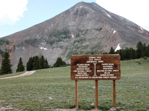
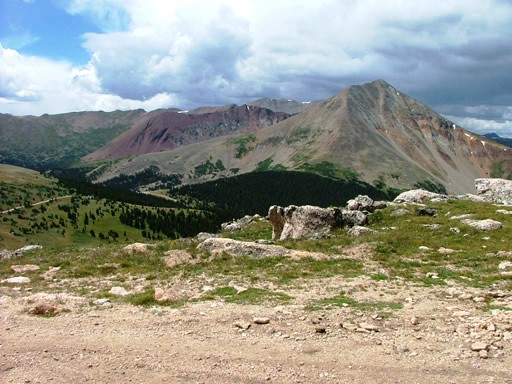
Cumberland Pass Road
   Cumberland Pass is one of Colorado's most scenic and historic passes. The trail is very easy and can be driven in a passenger car without any problems but is open to ATV's, dirt bikes, and Jeeps. The trail passes lots of mining history. With a sharp eye you will see old mines all long the road. Cumberland Pass between Pitkin and Tin Cup is the highest standard car road for summer use in the nation, and it is in good condition. It was constructed in 1882 to connect Tincup with the Denver-South Park railroad in Pitkin. From the summit you can view over 50 miles of the Continental Divide, as well as many of the abandoned mines of the area. The Cumberland Pass Road begins at the north end of Pitkin. Cumberland Pass is one of Colorado's most scenic and historic passes. The trail is very easy and can be driven in a passenger car without any problems but is open to ATV's, dirt bikes, and Jeeps. The trail passes lots of mining history. With a sharp eye you will see old mines all long the road. Cumberland Pass between Pitkin and Tin Cup is the highest standard car road for summer use in the nation, and it is in good condition. It was constructed in 1882 to connect Tincup with the Denver-South Park railroad in Pitkin. From the summit you can view over 50 miles of the Continental Divide, as well as many of the abandoned mines of the area. The Cumberland Pass Road begins at the north end of Pitkin.
Deer Creek Trail/Tanglewood Trail
  Drive west from Denver on US 285 for 28 miles to the traffic light before the top of Crow Hill. Turn right (northwest) on to Park County 43 and drive in a northwesterly direction for 6.8 miles to a "Y" in the road. Bear left and drive 2.1 miles, staying right at the campground, to the parking area at the trailhead. The Tanglewood Trail begins in the southeast corner of the Mt. Evans Wilderness, and climbs north into a saddle on the boundary between the Pike and Arapaho national forests. From that point, the trail continues north as the Roosevelt Lakes Trail and eventually ties into the trails on the east side of the Wilderness. Immediately east of the saddle (towards Rosedale Peak), area a series of pointed rock outcroppings called �Pegmatite Points.� The upper portions of the trail are above treeline. This location is also the treailhead for the southeast (lower) terminus of the Rosalie Trail. Because the trail is almost entirely in designated wilderness, Wilderness regulations apply. From the Deer Creek Trailhead, the Tanglewood and Rosalie trails go west and north up the Tanglewood Creek drainage to a junction just outside the Wilderness boundary. Here the two trails split and the Rosalie Trail bears left up an old logging road, while the Tanglewood Trail continues north along Tanglewood Creek. The trail climbs along Tanglewood Creek, and then begins to ascend toward the saddle above. The trail becomes more steep and strenuous, particularly after leaving the trees. The top of the saddle marks the boundary between Pike and Arapaho national forests. Drive west from Denver on US 285 for 28 miles to the traffic light before the top of Crow Hill. Turn right (northwest) on to Park County 43 and drive in a northwesterly direction for 6.8 miles to a "Y" in the road. Bear left and drive 2.1 miles, staying right at the campground, to the parking area at the trailhead. The Tanglewood Trail begins in the southeast corner of the Mt. Evans Wilderness, and climbs north into a saddle on the boundary between the Pike and Arapaho national forests. From that point, the trail continues north as the Roosevelt Lakes Trail and eventually ties into the trails on the east side of the Wilderness. Immediately east of the saddle (towards Rosedale Peak), area a series of pointed rock outcroppings called �Pegmatite Points.� The upper portions of the trail are above treeline. This location is also the treailhead for the southeast (lower) terminus of the Rosalie Trail. Because the trail is almost entirely in designated wilderness, Wilderness regulations apply. From the Deer Creek Trailhead, the Tanglewood and Rosalie trails go west and north up the Tanglewood Creek drainage to a junction just outside the Wilderness boundary. Here the two trails split and the Rosalie Trail bears left up an old logging road, while the Tanglewood Trail continues north along Tanglewood Creek. The trail climbs along Tanglewood Creek, and then begins to ascend toward the saddle above. The trail becomes more steep and strenuous, particularly after leaving the trees. The top of the saddle marks the boundary between Pike and Arapaho national forests.
Dennis Weaver Memorial Park
Dennis Weaver Memorial Park is just under 2.5 miles south of Ridgeway Reservoir located just off of US-550. The 60-Acre public park is a permanent wildlife preserve along the Uncompahgre River corridor. Within the park are miles of winding hiking and biking trails with a picninc area along the river.
Devil�s Backbone Loops
    Take US Hwy 34 (Eisenhower) west from Loveland to Hidden Valley Drive, which is just before the old water tank on the right side of Hwy 34. The intersection is 2 miles west of the intersection of Wilson and Hwy 34 in Loveland. If you get to Glade Rd., you've gone too far. Turn right on Hidden Valley Drive, proceed north about 1/4 mile, the parking lot is to the left (at the big Devil's Backbone sign) just before the entrance to the Hidden Valley housing development. The trailhead is at the northwest corner of the parking lot. Restrooms, water and picnic tables are available at the trailhead. Take US Hwy 34 (Eisenhower) west from Loveland to Hidden Valley Drive, which is just before the old water tank on the right side of Hwy 34. The intersection is 2 miles west of the intersection of Wilson and Hwy 34 in Loveland. If you get to Glade Rd., you've gone too far. Turn right on Hidden Valley Drive, proceed north about 1/4 mile, the parking lot is to the left (at the big Devil's Backbone sign) just before the entrance to the Hidden Valley housing development. The trailhead is at the northwest corner of the parking lot. Restrooms, water and picnic tables are available at the trailhead.
The Devil's Backbone Open Space is the southern parcel of open space lands and connector trails that stretch all the way to Lory State Park. Larimer County bought this parcel to protect the unique geology and wildlife habitat. The "Devil's Backbone" is an eroded rock formation on the west side of the park. The trails run along the east side of this formation. The names of the various trails in the Devil's Backbone Open Space are a little confusing. The trails extending from the Devil's Backbone Trailhead extend north continuously to Horsetooth Mountain Park via the Blue Sky Trail. However each section of the trail has a different name. The first leg of the trail is the Wild Loop Trail. It extends 1.3 miles from the Trailhead, and includes a loop made up of a western leg that runs closest to the Backbone, and an eastern leg that runs through the valley. The next segment is the Hunter Loop, which extends from the end of the Wild Loop Trail for 0.6 miles before splitting into two legs that again meet further to the northeast, creating another loop. At the far northeast end of the loop, the Laughing Horse Loop continues on, followed by the Blue Sky Trail which continues to Horsetooth Mountain Park. Along the way, the Rimrock Trail connects the Coyote Ridge Natural Area (accessed from trailhead on Taft Hill Rd. south of the Larimer County Landfill) with the Blue Sky Trail. This trail description adresses the Wild Loop and Hunter Loop Trails.
From the parking lot, you walk past a few picnic tables, then start climbing up the trail. For the first 0.4 miles, a ridge separates you from the Devil's Backbone, so the views are primarily of the valley and the housing development to the east. At 0.4 miles, (look for marker #2, the trail splits. This is the loop part of the trail. Go right, and you'll continue straight up the valley. Go left, and after hiking up a short rocky section of the trail, you will emerge from behind the ridge, and you'll begin to see the first section of the Devil's Backbone. The numbered sign posts also follow the trail to the left, so I recommend going on the left (west) route, and returning via the eastern trail. The next stretch of trail provides some of the best views of the Backbone, including several openings that have eroded in the rock. Also, watch the sky as you hike, this area is known for its hawks, ravens, swallows and owls. About 1/4 mile beyond the trail split is an overlook that offers terrific views of the valley just beyond the Backbone, and of the mountain ranges to the west. Looking east and south from the overlook gives you a view of the valley you just hiked up. Looking north, you see the continuation of the valley where you'll soon be hiking, and the homes and farms that populate the valley heading north towards Masonville. After the overlook, as you continue on the trail you'll come to another trail split. Here you can take the "keyhole" trail or the "bypass" trail. The keyhole trail climbs up to the Backbone, and is a little tougher than the bypass, but it takes you to the Keyhole, a good-sized hole that has eroded through the formation, again providing terrific views of the valleys and mountain ranges to the west. If you're hiking just the Wild Loop Trail (and not extending your hike with the Hunter Loop), the Keyhole is the highest elevation of the hike. From the Keyhole, the trail gently descends, first intersecting with the bypass trail, and at 1.3 miles from the trailhead, meets up with the eastern leg of the Wild Loop. From here, you can turn south on the eastern leg and return to the parking lot, making this a 2.5 mile loop. Or you can turn around and return on the western leg of the trail (where you just came from), making this a 2.6 mile out-and-back hike, and giving yourself a chance to see the backbone again from a different direction. Although the eastern trail doesn't have the views of the route you came up, it is straight and mostly flat, providing the quickest way back to your car. This point is also the beginning of the Hunter Loop Trail. If you would like to extend your hike to about 4.5 miles. Continuing north, the trail soon crosses the valley, continuing up the east side. Soon, the trail turns more to the east, and you begin a steady climb out of the valley to the ridgeline. At the top of the saddle, the trail splits, making the loop portion of the Hunter Loop. Turn right, and you'll continue south, climbing up the edge of a hill. Soon you'll turn back east again, skirting the edge of the hillside, and providing some great views of the Open Space. Soon you'll hit a split again. This is the intersection with the Laughing Horse Loop. Going right will take you to the Blue Sky Trail, going left will continue the loop and take you back to where you came from. Completing the Hunter Loop and returning via the eastern leg of the Wild Loop trail makes for a pleasant 4.5 mile hike, with two loops along the way.
Devil's Causeway/Stillwater Reservoir Trailhead
5.6 Miles RT
 From I-70, take the Wolcott exit and head north on Highway 131. Go 43 miles on 131 to the quaint town of Yampa. Take a left just before the gas station on the left side of the highway and pass through town. Hang a left on County Road 7. Follow County Road 7 for about 6 miles, then go an additional 9 miles on Forest Service Road 900 to the parking area on the north side of Stillwater Reservoir. Forest Service Road 900 is a well maintained road passable to any passenger vehicle. From I-70, take the Wolcott exit and head north on Highway 131. Go 43 miles on 131 to the quaint town of Yampa. Take a left just before the gas station on the left side of the highway and pass through town. Hang a left on County Road 7. Follow County Road 7 for about 6 miles, then go an additional 9 miles on Forest Service Road 900 to the parking area on the north side of Stillwater Reservoir. Forest Service Road 900 is a well maintained road passable to any passenger vehicle.
On this hike you'll gain about 1,600' in elevation. This trail initially parallels the north side of Stillwater Reservoir, which was constructed back in 1940. At 0.8 miles you will run into a registration/information board at the junction with trail #1120. Hang a right at the junction (heading north). You will reach the Flat Tops Wilderness Area boundary in another .2 miles. Next, you will pass Little Causeway Lake at mile 1.6. There is good camping and fishing at the Lake. From here you climb along and through talus slopes to the Bear River/ E. Fork of the Williams Fork watersheds divide at mile 2.3. A side trail on your left makes a steep ascent to the Devil's Causeway.
The Devil's Causeway is one of the most intriguing geologic structures in Colorado. This basaltic bridge is 50 feet long and a mere 5 feet wide. However, it appears even thinner when you're actually on top of it. It is a 1,000+ foot drop-off on either side of the bridge.
Devil�s Kitchen Trail
From the east entrance of Colorado National Monument near Grand Junction, drive 1/4 mile south on Rim Rock Drive and turn left into the parking area for Devils Kitchen Trail (and No Thoroughfare Canyon Trail and Old Gordon Trail). From the opposite direction, drive 17.8 miles from Saddlehorn Visitor Center to the start of the trail. There is a picnic area with bathrooms directly across from the trailhead. Devils Kitchen Trail is located near the south end of Colorado National Monument at the bottom of rugged No Thoroughfare Canyon. This 1.2-mile hike ascends 225 feet to visits an intriguing rock formation on the side of the canyon where tall boulders have enclosed a rock grotto.
Dillon Pinnacles
3.7 Miles RT
From Gunnison, drive 20 miles west on US 50 and turn right into the Dillon Pinnacles Trailhead (just north of the bridge across the Morrow Point Reservoir). This moderate 3.8-mile loop heads west from the roadside trailhead above the Morrow Point Reservoir. After 0.75 mile, follow the trail uphill past cedar and sage in Dillon Gulch to a junction where this route bears left. You'll wind through the exposed, high-desert landscape below volcanic formations known as the Dillon Pinnacles. If you can, avoid stopping at one of several benches on the trail and save your sitting for the best one: at the overlook between the reservoir and the 600-foot pinnacles (and the route's turnaround point).
Dillon Reservoir
Dillon Reservoir is situated right along I-70. You can take exit-203 for CO-9 toward Frisco and turn left onto Dillon Dam Rd, or exit-205 for US-6 E/CO-9 N toward Silverthorne/Dillon. During the winter months, ice fishing, and snowmobiling are common activities. With an elevation of 9,017 feet and 3,233 Acres this reservoir is surrounded by ski resorts, including Copper Mountain, Keystone, Arapahoe Basin, and Breckenridge. There is also a popular 18 mile paved bike path that winds around the entire reservoir.
Dolores River Canyon
  The Dolores River Canyon is located in southwestern Colorado, USA, west of the town of Naturita and north of the town of Dove Creek. Bedrock is located up the stunning Paradox Valley on highway 90 between Naturita and the Utah border. The only landmark for this once populated town is the old Bedrock store, now closed, that marks the turn off towards the boat ramp for the Dolores River. Past the boat ramp, the road travels up a short hill and splits into several directions. It took us a bit to find the road that continues down into the canyon. Be advised, this is a high clearance 4x4 road only. The route follows an old road and is very easy to follow. At times it is close to the river and at times farther away. Some milestones along the way include the sharp right turn at 0.87 miles, a traverse across an old stream bed at 2.0 miles, Indian petroglyphs at 2.5 miles and the junction with the Le Sal Creek at 3.0 miles. It looks like one could continue up the Le Sal a way, but the trail descended directly into the willows surrounding the creek. The Dolores River Canyon is located in southwestern Colorado, USA, west of the town of Naturita and north of the town of Dove Creek. Bedrock is located up the stunning Paradox Valley on highway 90 between Naturita and the Utah border. The only landmark for this once populated town is the old Bedrock store, now closed, that marks the turn off towards the boat ramp for the Dolores River. Past the boat ramp, the road travels up a short hill and splits into several directions. It took us a bit to find the road that continues down into the canyon. Be advised, this is a high clearance 4x4 road only. The route follows an old road and is very easy to follow. At times it is close to the river and at times farther away. Some milestones along the way include the sharp right turn at 0.87 miles, a traverse across an old stream bed at 2.0 miles, Indian petroglyphs at 2.5 miles and the junction with the Le Sal Creek at 3.0 miles. It looks like one could continue up the Le Sal a way, but the trail descended directly into the willows surrounding the creek.
The Dolores River is a tributary of the Colorado River, 250 miles long that runs through Colorado and Utah. It rises in southwestern Colorado near Dolores Peak and Mount Wilson in the San Miguel Mountains. It flows southwest, past the town of Dolores, where it turns, flowing north and northwest. It flows through the Dolores River Canyon, then cuts across Paradox Valley before receiving the San Miguel River in Montrose County and crossing into Utah, where it joins the Colorado in Grand County near the former Dewey Bridge. The Dolores is navigable by rafts and kayaks (up to class IV) from McPhee Reservoir to its confluence with the Colorado. When water is restricted from the reservoir it may be possible to boat down stream from the San Miguel River. However, the river is extensively used for irrigation and during low water years is wholly unnavigable. In high-runoff years, the section from Bradfield Ranch near Cahone, Colorado down to Slickrock, Colorado, offers scenery, camping, and rapids for inflatables and kayaks. The section from Slickrock to Bedrock, Colorado goes through the goosenecks of a sandstone canyon with several mostly class II rapids. The Bureau of Land Management recommends minimum flows of 200 cubic feet per second for canoes, kayaks, and inflatable kayaks, 800 cu ft/s for small rafts of up to 14 feet, and 1,000 cu ft/s for larger rafts of up to 18 feet in size. The BLM does not require permits for groups running the river in Colorado, though permits are required from the Moab BLM office for boaters wishing to make the run from Gateway, CO into Utah and to the confluence with the Colorado River near Dewey Bridge.
Durango & Silverton Narrow Gauge Railroad & Museum
This restored steam train offers scenic, seasonal rides that takes you up the canyon along the Animas River to the town of Silverton. There are options where you can take a shuttle back to town if you dont want to take the all day 8 hour roundtrip ride.
Eagle Wind Trail-Rabbit Mountain
4 Miles RT
   The Rabbit Mountain Trailhead is located 2 miles north of Highway 66 on N. 53rd Street. From Boulder: Head north on Highway 36 out of town towards Lyons. Highway 36 will dead end into Highway 66. Turn right on Highway 66 and continue for about 1 mile. Turn left into N. 53rd Street and follow it 2 miles until you see the Rabbit Mountain sign and parking lot on the right. There are 3 different trails to choose from at Rabbit Mountain Open Space: Eagle Wind, Indian Mesa, and Little Thompson Overlook. When you reach the first trail junction, a sign directs hikers to the right for the Eagle Wind and Indian Mesa Trails and to the left for the Little Thompson Overlook Trail. The Rabbit Mountain Trailhead is located 2 miles north of Highway 66 on N. 53rd Street. From Boulder: Head north on Highway 36 out of town towards Lyons. Highway 36 will dead end into Highway 66. Turn right on Highway 66 and continue for about 1 mile. Turn left into N. 53rd Street and follow it 2 miles until you see the Rabbit Mountain sign and parking lot on the right. There are 3 different trails to choose from at Rabbit Mountain Open Space: Eagle Wind, Indian Mesa, and Little Thompson Overlook. When you reach the first trail junction, a sign directs hikers to the right for the Eagle Wind and Indian Mesa Trails and to the left for the Little Thompson Overlook Trail.
Emerald Valley Pipeline Trail
5 Miles RT
  Drive 6.6 miles on the Old Stage Road, which snakes out of the city behind The Broadmoor on the way to Cheyenne Mountain Zoo. Turn left on Forest Road 371 at the sign for Emerald Valley Ranch. Continue another half-mile to a pass where the road drops into Emerald Valley. Drive a quarter of a mile and look for a pull-off on the right and park there. The hardest part of this hike is finding the start of the trail. Start by walking down the road from where you parked. Go around a bend to the right, less than a quarter of a mile, and keep an eye out for a trail on the right. You will see a few. The one you want has a section of 10-inch metal pipe exposed right where it meets the road. This is the Pipeline trail. The pipeline was built at least 70 years ago to deliver water from Rosemont Reservoir to The Broadmoor. The trail follows it in an almost perfect contour along the base of a rocky ridge that towers 2,000 feet above. The trail barely gains or loses a foot as it probes into a hidden pocket of aspen groves called Emerald Valley. Follow the clear trail for 2.5 miles until it ends at a jeep road. Here hikers have a choice. They can continue to explore up Emerald Valley, or they can turn down on the road and walk about a mile to Emerald Valley Ranch. Drive 6.6 miles on the Old Stage Road, which snakes out of the city behind The Broadmoor on the way to Cheyenne Mountain Zoo. Turn left on Forest Road 371 at the sign for Emerald Valley Ranch. Continue another half-mile to a pass where the road drops into Emerald Valley. Drive a quarter of a mile and look for a pull-off on the right and park there. The hardest part of this hike is finding the start of the trail. Start by walking down the road from where you parked. Go around a bend to the right, less than a quarter of a mile, and keep an eye out for a trail on the right. You will see a few. The one you want has a section of 10-inch metal pipe exposed right where it meets the road. This is the Pipeline trail. The pipeline was built at least 70 years ago to deliver water from Rosemont Reservoir to The Broadmoor. The trail follows it in an almost perfect contour along the base of a rocky ridge that towers 2,000 feet above. The trail barely gains or loses a foot as it probes into a hidden pocket of aspen groves called Emerald Valley. Follow the clear trail for 2.5 miles until it ends at a jeep road. Here hikers have a choice. They can continue to explore up Emerald Valley, or they can turn down on the road and walk about a mile to Emerald Valley Ranch.
Fish Creek Falls
From HWY-40 in Steamboat Springs turn onto 3rd St for 400 feet then turn right onto Fish Creek Falls Rd. Continue for another 3.2 miles to the Fish Creek Falls Parking Lot. This is a well maintained short hike to the 250ft waterfall, but you can continue past the falls to another waterfall and reservoir,and the trail eventually connects with Buffalo Pass and Rabbit Ears.
Fourth of July Trailhead
Fourth of July Mine-4 Miles RT : Diamond Lake-5.2 Miles RT : Caribou Lake-8 Miles RT
     From Nederland, head south on Colorado Highway 119 for 0.5 miles. Turn west onto County Road 130 (Eldora Ski Resort sign). Stay on the main road and through the town of Eldora. Once the pavement ends continue another five miles to the Fourth of July Trailhead. This portion of the road is rough but passable in a passenger car during the summer months. From Nederland, head south on Colorado Highway 119 for 0.5 miles. Turn west onto County Road 130 (Eldora Ski Resort sign). Stay on the main road and through the town of Eldora. Once the pavement ends continue another five miles to the Fourth of July Trailhead. This portion of the road is rough but passable in a passenger car during the summer months.
From the Fourth of July Trailhead, the Arapaho Pass Trail climbs the wooded, northern slope of the North Fork, Middle Boulder Creek drainage into the Indian Peaks Wilderness. The Diamond Lake Trail intersects after 1.2 miles. At 1.8 miles, Arapaho Pass Trail reaches the Fourth of July Mine and the Arapaho Glacier Trail intersects. The Arapaho Pass Trail continues west on an old road 1.2 miles farther to Arapaho Pass (elevation 11,906 feet). Continues north (right) from Arapaho Pass and drop 750 feet down a series of switchbacks to Caribou Lake. From here continue nine miles to Monarch Lake. For a side trip from the crest of Arapaho Pass, follow Caribou Pass Trail west along the ridge for about 0.25 miles to visit Lake Dorothy. Caribou Pass Trail continues on an impressive old road, blasted into a cliff, to Caribou Pass.
Diamond Lake is a high alpine lake that is relatively easy to get to. Although the best approach is from the Fourth of July Trailhead, Diamond Lake is also accessible from the Hessie Trailhead and another small trailhead located along Fourth of July Road. From the trailhead, the trail climbs 1.2 miles to the Diamond Lake Trail split-off. Next, it descends to the North Fork of the Middle Boulder Creek where it runs dead-smack into a beautiful cascade. From the creek, you have a little over one mile of incline to huff and puff through until you reach the Lake. About 1/2 mile west of Diamond Lake there is an old plane wreck.
The Fourth of July Road is the perfect adventure for folks looking for a gentle snowshoeing or cross country ski trip. You will be on established roads the entire time. Nonetheless, the excursion offers a decent backcountry experience. The hike begins by following the Fourth of July Road for just under one mile until reaching a fork. If you decide to head left, you will end up at the Hessie Trailhead. Instead, take a right towards the Fourth of July Trailhead. The road parallels the winding North Fork of the Middle Boulder Creek all of the way up to trailhead.
Georgia Pass Trail
   An interesting backcountry shortcut from town of Jefferson on Highway 285 to Breckenridge. The climb to the pass on the south side is an easy graded road. As you drop down the north side of the pass on Forest Road 355, it gets steeper and rougher, but there are no major obstacles. You�ll eventually run into Tiger Road, which becomes paved and passes through an upscale residential area including Breckenridge Golf Course. A road that heads east from the pass goes to high point at top of Glacier Peak. Running north along the west side of Glacier Peak is a narrow shelf road that eventually leads to a difficult descent down an obstacle called �Number 10 Hill.� Located in White River National Forest. Rating is based on a 2-mile stretch on the north side of the pass. OK for stock SUVs with low range unless snow covered. The trail may be impassable in the spring because of one wet area on the upper north side. It would be wise to wait until early July to make sure the trail has dried out. Late snow melt can keep the north side muddy in places. An interesting backcountry shortcut from town of Jefferson on Highway 285 to Breckenridge. The climb to the pass on the south side is an easy graded road. As you drop down the north side of the pass on Forest Road 355, it gets steeper and rougher, but there are no major obstacles. You�ll eventually run into Tiger Road, which becomes paved and passes through an upscale residential area including Breckenridge Golf Course. A road that heads east from the pass goes to high point at top of Glacier Peak. Running north along the west side of Glacier Peak is a narrow shelf road that eventually leads to a difficult descent down an obstacle called �Number 10 Hill.� Located in White River National Forest. Rating is based on a 2-mile stretch on the north side of the pass. OK for stock SUVs with low range unless snow covered. The trail may be impassable in the spring because of one wet area on the upper north side. It would be wise to wait until early July to make sure the trail has dried out. Late snow melt can keep the north side muddy in places.
Hays Creek Falls
This is just a short 50 foot stroll to the waterfall that sits right off of CO-133. From the junction of CO-82 in Carbondale head south on CO 133 for 19 miles and the pullout will be on your right.
Hessie Trailhead
Lost Lake Trail-3 Miles RT : Jasper Lake-9 Miles RT : Devil�s Thumb Pass-14.2 Miles RT
     From Nederland, head south on Colorado Highway 119 for 0.6 miles. Turn west onto County Road 130, signed for Eldora. Follow the paved road through the valley to the Town of Eldora, where the pavement ends. Continue beyond the end of the pavement for 0.75 miles to the fork in the road. The left fork goes to Hessie Trailhead. This trailhead gives you access to several trails including Lost Lake Trail, King Lake Trail, & Devil�s Thumb Trail. From Nederland, head south on Colorado Highway 119 for 0.6 miles. Turn west onto County Road 130, signed for Eldora. Follow the paved road through the valley to the Town of Eldora, where the pavement ends. Continue beyond the end of the pavement for 0.75 miles to the fork in the road. The left fork goes to Hessie Trailhead. This trailhead gives you access to several trails including Lost Lake Trail, King Lake Trail, & Devil�s Thumb Trail.
Lost Lake Trail follows a closed jeep track the majority of the way. There are a couple old mines and cabins on the mountainside to the south of Lost Lake. Additionally, this hike showcases the backside of Eldora Ski Resort relatively well. Above Lost Lake, Jasper Creek divides into three drainages, each with a good trail system. The southern basin reaches King Lake and the twin Betty and Bob Lakes below Rollins Pass. The middle basin holds Woodland Lake and the Skyscraper Reservoir. The northern drainage holds the artificial Jasper Lake (campsites) and the lovely Devil's Thumb Lake. Each requires a 4-6 mile approach, but is well worth the effort. Established trails from the north and south drainages access the Divide and can be connected via a 2.5 mile stretch of the Continental Divide Trail. The "Hessie Loop" is a great hike or trail run.
Devil�s Thumb Pass is a great day hike experience. You will gain 3,000 feet in elevation on this hike, topping out near 12,000 feet. You can find spots to pitch a tent around Jasper Lake, as well a couple flat locations near Devil's Thumb Lake. Backpacking permits are required in the Indian Peaks Wilderness Area between June 1 & September 15.
Woodland Lake is nestled high in the mountains between the valley leading to King, Bob, and Betty Lakes and the valley winding up to Devil's Thumb Pass. Initially, this hike follows an old jeep road for approximately .5 miles. At the intersection of Devil's Thumb Trail (Trail 902) and the Devil's Thumb Bypass Trail, take a left and pass over the bridge. After hiking a total of 1.4 miles, the trail hits the junction with the King Lake Trail (Trail 901). Keep right on the Devil's Thumb Trail. Soon after entering the Indian Peaks Wilderness Area you will encounter the junction with the Woodland Lake Trail (Trail 811). Take a left, and continue on up the trail for another 2 miles. Skyscraper Reservoir is a .5 miles beyond Woodland Lake.
Ironton Park-Colorado Boy Mine Area
1.8 Miles RT-Moderate
Colorado Boy Mine is 13 miles north of Silverton or 8.6 miles south of Ouray. Part of the Red Mountain Mining District located in the Ironton Park area. There is a trail near the Ironton ghost town that leads you to the mine. The building that surrounds the vertical mine shaft of the Colorado Boy Mine is visable to passing motorists on the Million Dollar Highway traveling through Ironton Park.
James Peak Trailhead
8 Miles RT
   Four miles south of Nederland, take a right (west) on County Road ("CR") 16 (East Portal Road) out of the town of Rollinsville. After driving 5 miles you'll hit the Town of Tolland: take a left onto CR 4N. Follow CR 4N 3.5 miles; take a right onto National Forest System Road (NFSR) 353 (this road requires a high-clearance, 4 X 4 vehicle). Continue on NFSR 353 west for another 3.3 miles until you reach the James Peak Lake Trailhead. Four miles south of Nederland, take a right (west) on County Road ("CR") 16 (East Portal Road) out of the town of Rollinsville. After driving 5 miles you'll hit the Town of Tolland: take a left onto CR 4N. Follow CR 4N 3.5 miles; take a right onto National Forest System Road (NFSR) 353 (this road requires a high-clearance, 4 X 4 vehicle). Continue on NFSR 353 west for another 3.3 miles until you reach the James Peak Lake Trailhead.
Nestled at 13,294 feet in elevation, James Peak is a close escape from the Boulder/Denver metro area. There are numerous high-alpine lakes, including Little Echo Lake and James Peak Lake. James Peak Wilderness Area is 14,000 acres in sum. Congress designated the area as wilderness in 2002. Indian Peaks Wilderness Area is located directly to the north.
Lake Granby
Located just outside of the Rocky Mountain National Park right off of US 34 about 5 miles north of Granby, CO. Lake Granby is the third largest body of water in Colorado. The dam was completed in 1950 with 40 miles of shoreline with a maximum depth of 221 feet.
Long Lake Trailhead
Long Lake-.4 Mile RT : Lake Isabelle-4.2 Miles RT
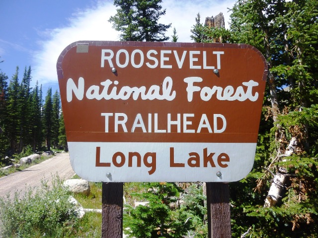 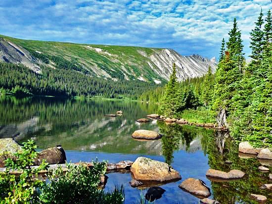 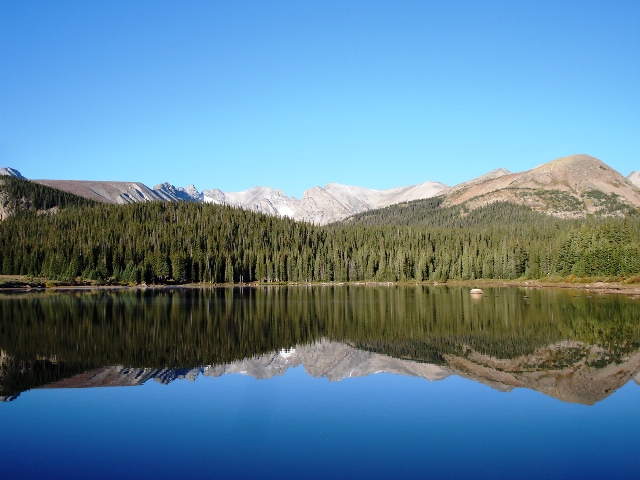  The Long Lake Trailhead is within the Brainard Lake Recreation Area, off Highway 72, 13 miles north of Nederland, and just north of Ward. Turn west onto Brainard Lake Road (County Road 102, National Forest System Road 112). (Note: This road is closed at the halfway point to Brainard Lake from late October through late June/early July). Travel 5 miles on the paved road to Brainard Lake. The Long Lake Trailhead is .5 miles up the left fork of a side road that turns off at the west end of Brainard Lake. If you are traveling to Lake Isabelle in the snowy months, it is necessary to have decent orientation skills. Not many individuals travel to the lake in the snow, and many times you will find yourself breaking trail the entire time. Heading out from the Long Lake Trailhead, the trail begins its relatively gentle ascent up to Long Lake and Lake Isabelle. After a quarter-mile of trekking, the trail intersects the Jean Lunning Trail, which will take you over to and around Long Lake. Avoid the Jean Lunning Trail and continue uphill to Lake Isabelle. After 1 mile, the trail intersects the Jean Lunning Trail for the second time. Again, continue strait towards Lake Isabelle and Pawnee Pass, bypassing the Jean Lunning Trail. Lake Isabelle is just another .9 miles beyond this trail junction. The Long Lake Trailhead is within the Brainard Lake Recreation Area, off Highway 72, 13 miles north of Nederland, and just north of Ward. Turn west onto Brainard Lake Road (County Road 102, National Forest System Road 112). (Note: This road is closed at the halfway point to Brainard Lake from late October through late June/early July). Travel 5 miles on the paved road to Brainard Lake. The Long Lake Trailhead is .5 miles up the left fork of a side road that turns off at the west end of Brainard Lake. If you are traveling to Lake Isabelle in the snowy months, it is necessary to have decent orientation skills. Not many individuals travel to the lake in the snow, and many times you will find yourself breaking trail the entire time. Heading out from the Long Lake Trailhead, the trail begins its relatively gentle ascent up to Long Lake and Lake Isabelle. After a quarter-mile of trekking, the trail intersects the Jean Lunning Trail, which will take you over to and around Long Lake. Avoid the Jean Lunning Trail and continue uphill to Lake Isabelle. After 1 mile, the trail intersects the Jean Lunning Trail for the second time. Again, continue strait towards Lake Isabelle and Pawnee Pass, bypassing the Jean Lunning Trail. Lake Isabelle is just another .9 miles beyond this trail junction.
Longs Peak Trailhead
14 Miles RT
   From Estes Park take US Hwy 36 east from the intersection of Hwy 34/Hwy 36 for 0.4 miles, to the intersection of CO Hwy 7. Take CO Hwy 7 right (south) and proceed south for 8.9 miles to the entrance to the Longs Peak Ranger Station and Campground. There is a sign here, and it's a hard right turn after a sweeping left. Turn right and proceed another mile to the trailhead. The campground is on the right and the ranger station and trailhead is on the left. From Estes Park take US Hwy 36 east from the intersection of Hwy 34/Hwy 36 for 0.4 miles, to the intersection of CO Hwy 7. Take CO Hwy 7 right (south) and proceed south for 8.9 miles to the entrance to the Longs Peak Ranger Station and Campground. There is a sign here, and it's a hard right turn after a sweeping left. Turn right and proceed another mile to the trailhead. The campground is on the right and the ranger station and trailhead is on the left.
From Boulder take Canyon Blvd (Hwy 119) east to US Hwy 36 (28th St). Turn left (north) and proceed out of town on Hwy 36. After 15 miles you'll reach the intersection of US Hwy 36 and CO Hwy 66. Take a left and continue west on Hwy 36 into Lyons. Total distance from Canyon/28th in Boulder to downtown Lyons is 16.3 miles. From downtown Lyons, take CO Hwy 7 west up South Saint Vrain Canyon. At 14 miles you'll pass CO Hwy 72 (Peak to Peak Hwy), at 18.75 miles you'll pass Allenspark, and at 20.5 miles you'll pass the Wild Basin Entrance. Continue on Hwy 7 for a total of 24.3 miles from Lyons to the Longs Peak Ranger Station and Campground entrance. There is a sign here, and it's a left turn right before a sweeping right. Turn left and proceed another mile to the trailhead. The road to the trailhead and the parking area is plowed in the winter also.
The Longs Peak Trailhead is the primary means for accessing Longs Peak, and is the trailhead for the popular East Longs Peak Trail. This area is located on the east side of Rocky Mountain National Park. Unlike other access points in RMNP, no entrance fees are required to access this area. The trailhead also features a ranger station (with an emergency phone) and a small campground. Camping is first-come, first-served, limited to 3 consecutive days, and is tents only. To reach the summit there will be climbing required and experienced climbers are recommended.
Maxwell Falls Trail
4 Miles RT
   From Evergreen: Take Highway 74 to the center of Evergreen. Turn right at the stoplight onto Highway 73. Go to Brook Forest Rd. and turn right. The lower trailhead is encountered first. To access the upper trailhead go past the lower trailhead to Black Mountain Road. On Black Mountain Road turn left and go 1.25 miles to the upper trailhead. Maxwell Falls Trail is a 4 mile loop trail located near Evergreen, Colorado that features a waterfall and is rated as moderate. The trail is primarily used for hiking and is accessible from March until November. Dogs are also able to use this trail but must be kept on leash. From Evergreen: Take Highway 74 to the center of Evergreen. Turn right at the stoplight onto Highway 73. Go to Brook Forest Rd. and turn right. The lower trailhead is encountered first. To access the upper trailhead go past the lower trailhead to Black Mountain Road. On Black Mountain Road turn left and go 1.25 miles to the upper trailhead. Maxwell Falls Trail is a 4 mile loop trail located near Evergreen, Colorado that features a waterfall and is rated as moderate. The trail is primarily used for hiking and is accessible from March until November. Dogs are also able to use this trail but must be kept on leash.
Mesa Creek Trail
1.5 Miles RT:Easy
From Montrose, CO drive 19.50 miles east on HWY50 and turn north onto Morrow Point Dam Rd in Cimarron for another 1.45 miles to the trailhead from parking lot. This is one of the best trails I have ever been on with great views from the base of Morrow Point Dam & well maintained trail. A footbridge crosses over the Gunnison River where you follow it heading west for .75 mile before you come to the end. This section of the river is called Crystal Reservoir.
Mesa Verde National Park
From Cortez, CO head head east on US-160 for 10 miles to the exit for Mesa Verde National Park. Keep in mind some of these trails require a guide so make sure to check in at the Visitor Center before exploring.
Trails in the Park
Balcony House Loop Trail
Badger House Community
Cliff Palace Loop Trail
Far View Sites Complex
Farming Terraces Trail
Long House Trail
Mesa Top Loop Road
Knife Edge Trail
Park Point Overlook Trail
Petroglyph Point Trail
Point Lookout Trail
Prater Ridge Trail
Rock Springs Trail
Soda Canyon Overlook Trail
Spruce Canyon Trail
Spruce Tree House Trail
Step House Trail
Million Dollar Highway
USA Route 550 (Million Dollar Highway) is a spur of US HWY 50 that runs from Bernalillo, NM to Montrose, CO. The section from Silverton to Ouray is frequently called the Million Dollar Highway. It is a two-lane mountainous highway and stretches for about 25 miles. This stretch through the gorge is challenging and potentially hazardous to drive with steep cliffs, narrow lanes and lack of guard rails.
North Supply Creek Trail
16 Miles RT
 From Denver, take I-70 west to US 40 north (to Empire). Take this past Winter Park and Granby. On the far side of Granby the right lane splits off to US 34. Take this to the town of Grand Lake. Just before Grand Lake the road forks, take the left fork here to go past the town. After seeing signs to the Kawuneeche Visitor Center you take the next left on County Road 491. Turn left on Road 492 and take the dirt road until it ends at a parking area. From the trailhead, follow the trail for less than half a mile to a junction. Turn right here on the Blue Ridge/Wolverine Trail. Just after this junction is another one. Take the left fork first. Not far after this junction, turn right onto the Continental Divide Trail and head up the steep trail to another junction near the top of the ridge. Turn right here and follow the ridge north. Pass the junction with the Lost Lake Trail on the left and continue north along the trail. After less than a mile you will reach another junction with the North Supply Trail. The trail continues up the Blue Ridge and trends west to the west side, staying on that side of the ridge all the way to the Saddle above Bowen Lake. Instead of descending Bowen Lake, turn left and continue along the ridgeline. This trail eventually passes close to the summit of Cascade Mountain. When the trail fades away you have the choice of either to continue contouring around the mountain before making the final climb to the east or by heading up to the ridgetop right when the trail fades away. Once you reach the ridgetop you can climb directly over a false summit to the true summit. From Denver, take I-70 west to US 40 north (to Empire). Take this past Winter Park and Granby. On the far side of Granby the right lane splits off to US 34. Take this to the town of Grand Lake. Just before Grand Lake the road forks, take the left fork here to go past the town. After seeing signs to the Kawuneeche Visitor Center you take the next left on County Road 491. Turn left on Road 492 and take the dirt road until it ends at a parking area. From the trailhead, follow the trail for less than half a mile to a junction. Turn right here on the Blue Ridge/Wolverine Trail. Just after this junction is another one. Take the left fork first. Not far after this junction, turn right onto the Continental Divide Trail and head up the steep trail to another junction near the top of the ridge. Turn right here and follow the ridge north. Pass the junction with the Lost Lake Trail on the left and continue north along the trail. After less than a mile you will reach another junction with the North Supply Trail. The trail continues up the Blue Ridge and trends west to the west side, staying on that side of the ridge all the way to the Saddle above Bowen Lake. Instead of descending Bowen Lake, turn left and continue along the ridgeline. This trail eventually passes close to the summit of Cascade Mountain. When the trail fades away you have the choice of either to continue contouring around the mountain before making the final climb to the east or by heading up to the ridgetop right when the trail fades away. Once you reach the ridgetop you can climb directly over a false summit to the true summit.
Paonia Reservoir
Paonia Reservoir lies just to the south off of CO-133 about 42 miles south of Carbondale.
Pioneer Cemetary Trailhead/Doc Holliday's Grave Trail
From I-70-Take CO-82 from Glenwood Springs southeast on Grand Ave toward 8th St for .6 mile. Turn left onto 13th St for .2 mile where the trailhead is. This moderate short uphill trail leads you to the gravesite of gunslinger Doc Holliday in Linwood Cemetary and offers views of Glenwood Springs valley.
Platte River Trail
28.5 Miles One-Way
You can access this trail from numerous locations.
Grant Frontier Park: S. Platte River Drive, north of W. Wesley Ave.
Overland Lake Park: S. Platte River Drive at W. Florida Ave.
Frog Hollow Par: W. 8th Ave., west of I-25/US 87/US 85/US 6
Gates Crescent Park: East of I-25/US 87/US 85/US 6 across from Invesco Field.
Steele Street and E. 78th Ave.
Platte River Trailhead Park, Colorado Blvd.
Northern Terminus at E. 104th Ave.
The Platte River Greenway Trail follows the Platte River through downtown Denver for 28.5 Miles. The Denver Historical Society has placed 30 plaques at points along the trail to tell you about the historic sires along the way. The trail connects you to several shopping outlets & entertainment. (REI-Six Flags-Pepsi Center-Broncos Stadium-Denver Aquarium & Museum, and many restaurants and bars.)
Red Rocks Park
Red Rocks Amphitheatre is located in Red Rocks Park near Morrison, Colorado, 15 miles west of Denver. Coming from Downtown, take I-70 west to exit 259, turn left at the bottom of the Morrison exit ramp, cruise on downhill 1.5 miles to the Red Rocks Park entrance. Coming from south Denver, take C-470 to the Morrison exit, turn west and follow the signs to the Park entrances. Here's a tip to avoid some traffic: You can also exit C-470 at Highway 285. Take it west to Highway 8 and then come north to the Amphitheatre!
Entrance #2 off of Highway 93 into Red Rocks Park and Amphitheatre is closed due to ongoing bridge reconstruction on Road 2. Patrons attending concerts or visiting the park and amphitheatre should use entrances 1 or 3 and plan to arrive early. Will Call traffic should use Entrance 1 to gain access to the box office. During concerts, limited traffic may be directed to use Entrance #2.
Rock climbers will enjoy over 80 climbing routes - all bolted sports climbs. (Climbers must register at the Garden of the Gods Visitor Center.) Some trails are for hikers only. Dogs must be leashed except in the designated off-leash area. Be prepared to park in the overflow lot on 31st Street, around the corner from the main lot, on weekends due to the popularity of this open space. The latest Master Plan for Red Rock Canyon Open Space combined what was once known as Section 16, White Acres Open Space and Red Rock Canyon into one Open Space area, known collectively now as Red Rock Canyon Open Space, with a total of 1,474 acres. Section 16 trailhead has been a favorite for hikers and bicyclists since the 1970's.The moderately difficult 6 Palmer-Red Rocks Loop trail gains 800' of elevation and loops through beautiful mountain scenery. There is a connection to the Paul Intemann Nature Trail, which leads to the Barr Trail up Pikes Peak at the west end of Manitou Springs. The Section 16 trailhead can be reached by exiting Highway 24 West at the 26th Street intersection. Head south and turn right on Lower Gold Camp Rd at the 4-way stop. The Section 16 trailhead is a short distance on the right. Red Rocks Park is open daily from 5AM to 11PM and is free of charge. In the event of a performance the Amphitheatre and Visitor Center will generally close to the public in the early afternoon hours. Park Rangers patrol the park to assist visitors, provide information, and enforce park rules. To contact a Park Ranger call (720) 913-1311.
Ridgway State Park
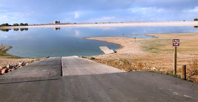
Ridgway State Park is located 3.50 miles north of the town Ridgway and sits just off of US-550 to the north.
Royal Gorge Bridge
From Denver take I-25 south to HWY-155 for 33 miles to HWY-50 west for 15 miles then turn south on Cty Rd 3A and drive 4 miles to the park. The Royal Gorge Bridge is a tourist attraction near Canon City, CO. The bridge crosses the Royal Gorge 955 feet above the Arkansas River, and held the record of the highest bridge in the world from 1929 to 2001. On June 12, 2013, the Royal Gorge Bridge and Park was devastated by a wildfire destroying 48 buildings, the Incline Railway, and the Ariel Tram. The park re-opened by September 2015. Attractions currently are the Visitor Center, Water Clock, Aerial Trams, Plaza Theatre, Children's Playland, Carousel, Skycoaster, and the Cloudscraper Zipline.
Sloans Lake Park
2.3 Mile Loop
Located just west of I-70 and � mile west of the Broncos Stadium. 17th Ave & Sheridan Blvd. You can take I-15 West and turn north on 17th Ave to Sheridan Blvd. Theres a couple parking lots here where you can gain access to the lake. Sloans Lake Park is an urban oasis, with the enormous Sloan's Lake taking center stage. In the summer be sure to keep an eye out for water skiers zooming across the lake, framed by a stunning view of the Denver skyline. Bring some food to grill and spread out a picnic blanket or two - there's plenty of room at this 177-acre park. Sloan's Lake hosts the annual Colorado Dragon Boat Festival, a celebration of Asian American culture and tradition, featuring a host of amazing dragon boats filling the lake. There is a paved path that goes around the entire lake.
Watson Lake
From Fort Collins, go north on HWY-287 from HWY-14 to LaPorte. Go 1 mile west on County Road 54G to County Road 52E. Then 1 mile west to the entrance. This lake host the fish hatchery just south of it raising about 30,000 trout annually
|
