|
|
Big Sand Wash Reservoir GPS-N.40.17.796-W.110.14.072 : Elevation-5,885 ft   From Duchesne, head east 9 miles on US 40, and turn north at milepost 98.2. Follow this road for a mile, then north-east and north on a paved country road for about 8 miles to U-87. Turn left on U-87 and continue north for 2 miles, through Upalco, to where U-87 bends to the northwest. At the bend, continue north on an unpaved road for 0.75 miles to the boat ramp. At milepost 105, there will be a sign to a Big Sand Wash boat ramp south of the highway. From Duchesne, head east 9 miles on US 40, and turn north at milepost 98.2. Follow this road for a mile, then north-east and north on a paved country road for about 8 miles to U-87. Turn left on U-87 and continue north for 2 miles, through Upalco, to where U-87 bends to the northwest. At the bend, continue north on an unpaved road for 0.75 miles to the boat ramp. At milepost 105, there will be a sign to a Big Sand Wash boat ramp south of the highway.
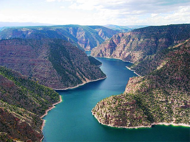
Flaming Gorge Elevation-6,023 ft     Access to Flaming Gorge; Cedar Springs Marina is near the dam at the lower end of the lake on US-191 between Green River; Lucerne Valley Marina is near the central section of the lake near Manilla; To reach Buckboard Marina from Evanston head east on I-80 for 77 miles and take exit 83 to CR-37. Drive south for 10 miles to SR-530 and turn south. Drive another 18.25 miles to the turnoff on your left 1.31 miles to the marina. This marina includes camping, restrooms, launch ramp, and a dump station. Access to Flaming Gorge; Cedar Springs Marina is near the dam at the lower end of the lake on US-191 between Green River; Lucerne Valley Marina is near the central section of the lake near Manilla; To reach Buckboard Marina from Evanston head east on I-80 for 77 miles and take exit 83 to CR-37. Drive south for 10 miles to SR-530 and turn south. Drive another 18.25 miles to the turnoff on your left 1.31 miles to the marina. This marina includes camping, restrooms, launch ramp, and a dump station.
Bear Lake Deer Creek Reservoir East Canyon Reservoir Echo Reservoir Gunnison Bend Reservoir Gunlock Reservoir Huntington Reservoir Hyrum Reservoir Joes Valley Reservoir Jordanelle Reservoir Lake Powell Mantua Reservoir Millsite Reservoir Mona Reservoir Otter Creek Reservoir Pineview Reservoir Piute Reservoir Quail Creek Reservoir Recapture Reservoir Redmond Reservoir Rockport Reservoir Sand Hollow Reservoir Scofield Reservoir Starvation Reservoir Strawberry Reservoir Utah Lake Willard Bay Yuba Reservoir Minersville Reservoir GPS-N.38.13.048-W.112.49.047 : Elevation-5,503 ft From Beaver, head west on UT 21 for 12 miles to the entrance on the southwest side of the reservoir. Minersville State Park has a sanded beach, a concrete public boat ramp, hot showers, and picnic areas. Red Fleet Reservoir GPS-N.40.35.010-W.109.25.728 : Elevation-5,608 ft : Water Temperature-5/24/09-61 : 10/12/09-60     From Vernal head north on US 191 for 13 miles, and turn right. Go west for 2 miles to the state Park entrance. A boat launch area is on the right on a gravel road shortly after turning off US-191, but the main park facility is further east. Usage fees are charged. The red sandstone cliffs and canyon walls provide a beautiful backdrop to the blue water of the reservoir. There are campsites, a swimming beach, a boat ramp, modern rest rooms, and sewage disposal. From Vernal head north on US 191 for 13 miles, and turn right. Go west for 2 miles to the state Park entrance. A boat launch area is on the right on a gravel road shortly after turning off US-191, but the main park facility is further east. Usage fees are charged. The red sandstone cliffs and canyon walls provide a beautiful backdrop to the blue water of the reservoir. There are campsites, a swimming beach, a boat ramp, modern rest rooms, and sewage disposal.
Steinaker Reservoir Elevation-5,520 ft : Depth Maximum-129.9 ft/Mean- 45.9 ft : Water Temperature-5/24/09-62 : 10/12/09-60     4 miles north of Vernal. The highway follows the east shore for about a mile. An access road leads across the north end of the reservoir to the state park. The state park has a concrete boat launch, modern rest rooms with showers, sewage disposal, sandy beaches, and fish cleaning stations. 4 miles north of Vernal. The highway follows the east shore for about a mile. An access road leads across the north end of the reservoir to the state park. The state park has a concrete boat launch, modern rest rooms with showers, sewage disposal, sandy beaches, and fish cleaning stations.
Lakes by distance from 7800-S and 4000-W One-Way Utah Lake-Pelican Bay Marina-28 Miles/West Side Beach-36 Miles East Canyon Reservoir-43 Miles Jordanelle Reservoir-44 Miles Deer Creek Reservoir-51 Miles Rockport Reservoir-52 Miles Echo Reservoir-57 Miles Pineview Reservoir-62 Miles Willard Bay-65 Miles Mona Reservoir-66 Miles Hyrum Reservoir-89 Miles Scofield Reservoir-98 Miles Electric Lake-101 Miles Yuba Reservoir-104 Miles Bear Lake-116 Miles Starvation Reservoir-121 Miles Huntington Lake-131 Miles Gunnison Bend Reservoir-132 Miles Big Sand Wash Reservoir-141 Miles Redmond Lake-145 Miles Millsite Reservoir-156 Miles Joes Valley Reservoir-159 Miles Steinaker Reservoir-186 Miles Piute Reservoir-191 Miles Red Fleet Reservoir-196 Miles Flaming Gorge/Buckboard Marina-198 Miles Otter Creek Reservoir-210 Miles Quail Creek Reservoir-283 Miles Minersville Reservoir-294 Miles Sand Hollow Reservoir-294 Recapture Lake-297 Miles Gunlock Reservoir-313 Miles Lake Powell-317 Miles to Bullfrog Bay 
Custom Search
|