Located about 30 miles east of the town of Panaca on a rough road, Beaver Dam is one of the least accessible state parks in Nevada. It is in the Eastern Nevada Region of Nevada State Parks. Beaver Dam State Park was created by the Nevada Legislature in 1935. Schroeder Lake, a 15-acre reservoir built in the park in 1962, was breached in 2005 after a winter of intense rainfall left the dam dangerously weakened. The lake was built on Beaver Dam Wash, which drains much of the surrounding area before emptying into the Virgin River in far northwest Arizona. The deep canyons, flowing streams, waterfalls, pinyon, juniper and ponderosa forests of Beaver Dam have beckoned people for centuries. Today, a visit to Beaver Dam State Park allows visitors to experience the pristine, natural beauty and primitive, rustic character that distinguishes this park from all others. The park is about three hours north of Las Vegas on the Utah border. Camping and fishing along the streams of Headwaters and Pine creeks goes back centuries, to a time when Native Americans inhabited what is now Beaver Dam State Park. A group of emigrants stumbled upon the valley in 1849 while looking for a quicker route to California. They did not find a shortcut, just steep cliffs and valleys that were difficult to cross. They continued on the their way, leaving their wagons and some initials carved in stone, taking with them stories and descriptions which would later bring permanent settlers to the areas now known as Beaver Dam and Barclay. One family of settlers, the Hamblins, built a small house, a blacksmith shop and a one-room schoolhouse for the children in the Beaver Dam Wash area. Remnants of the Hamblin Ranch settlement can be seen at the northern end of the park. This archeological site is protected by state law and the removal of artifacts is prohibited. The heavily wooded area, with its free-flowing streams, offered a welcome respite in the summer months for the families that settled the area. Improvements in 1917 to the Acoma-Shem highway, the main wagon road into Utah, made access to the area easier and spurred interest in designating Beaver Dam Wash as a park. Beaver Dam became one Nevada's first State Parks in 1935. The Civilian Conservation Corps (CCC) constructed camping and picnicking areas between 1934 and 1936, but flooding in the late 1930s destroyed the majority of these facilities. In 1961, new camping and picnicking facilities were built and a manmade-earthen dam was constructed creating Schroeder Reservoir. Flooding in 2005 damaged the dam, and in 2009 the reservoir was drained and Beaver Dam Wash was restored to its natural, pre-dam state.
Camping: There are two developed campgrounds offering individual campsites, each containing a fire pit, picnic table and parking suitable for one vehicle and a small trailer. Camping is first-come, first-serve; sites may not be reserved. Drinking water is available from April through November. Vault toilets are available year-round. Camping fees apply all year; rates are posted at the campground. There is no trailer dump station at the park. Camping is limited to 14 days in a 30-day period.
Group Area: The group area in Campground B has a large shade ramada, table space for 60 and horseshoe pits. It may be reserved for day or overnight use by arrangement with the park office. Reservation and per-vehicle fees apply.
Day Use: A day-use area is at the east end of Campground A. It has picnic tables, potable water, barbecue pits and restroom facilities. A turnaround parking area accommodates larger rigs. The park entrance fee applies. At the park's southern boundary lies another picnic area. At the Waterfall Trailhead visitors can sit under the shade of an old cottonwood tree and have a picnic before hiking up the trail.
Fishing: Fishing opportunities abound in the streams below the day-use area and Oak Knoll. The Nevada Department of Wildlife stocks the streams with rainbow trout. A Nevada Fishing License with a trout stamp is required for anglers over age 12. Licenses should be purchased prior to visiting; licenses are not sold in the park. There is a five-trout limit per person.
Hiking: The park's trails offer all levels of hiking experience. See incredible views of the canyon from the vantage point high on the Overlook Trail. From there is a 360-degree view of the park; to the north, the remnants of Hamblin Ranch, and also where Headwater and Pine creeks merge forming Beaver Dam Wash, and to the south, the Beaver Dam Wash canyon that directs the streams to Littlefield, Arizona and into the Virgin River. Access this loop trail at the southern end of Campground B. The ascent to the viewpoint is a moderate hike. From the Oak Knoll Trail, go for an easy hike and bring a fishing pole because this trail descends to the stream bank where there are rainbow trout. This easy trail is southeast of the campgrounds. Follow the park road south about .5 miles, turn left at the Oak Knoll sign onto the spur road and park at the gate. The Waterfall Trail offers streams, warm springs and waterfalls that drew the Civilian Conservation Corps to this part of the park during its stay in 1934-35. Visitors can explore the pond and natural Jacuzzi remnants of days-gone-by. Hiking the trail offers visitors a glimpse into the past and incredible scenery. This easy-to-moderate trail is near the southern boundary of the park.
Bluestone Mine Trail
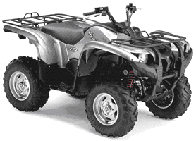

7.4 Miles


This trail begins in the town of Mason and travels past the remains of the Bluestone Mine and then through a narrow but scenic canyon within the hills of the Singatse Range. It ends at the intersection with Western #27: Ludwig Ghost Town Trail. Begin by following Nevada 339 north from Mason to the intersection with Weed Heights Road, near a massive tailings dump. From this intersection, the trail turns west toward the hills. There are numerous remains of the Bluestone Mine and near the Ludwig town site.
Carson River Trail


38 Miles


To access these trails, ride along Alt 95 from Ft. Churchill or park at the trailhead area. The ride along the maintained dirt road is flat and offers great high desert scenery with mountains to the south and a large alkali flat to the north. At the end of the primary dirt road is a series of well used jeep roads adjoining several older jeep loops. To travel along the Carson River Drainage, take the first well used road to the northeast. This road can be ridden to the Lake Lahontan State Recreation Area.
Hafen Park


Hafen Park is in the City of Mesquite,NV located at 450 West on Hafen Lane. Park Hours are Sunday-Thursday 5am-10pm and Friday-Saturday 5am-11pm. The park has Pavilions, a Shaded Playground, BBQ's, Restrooms with Drinking Fountain, Lights, 4 Tennis Courts, Fishing Pond, Basketball Area, a Walkin Path, and a Splash Pad.
Logandale Trails


From Las Vegas take I-15 N to Exit 93 toward N Moapa Blvd. Turn right on N Moapa Blvd. Turn right on Liston and head west following the road (Mills/N Pioneer) as it turns to dirt and follows the train tracks north and then west again. There will be a large staging area with a kiosk.
Lovell Canyon Trail


5.5 Miles RT

From Las Vegas, take I-15 south to the Blue Diamond exit and take SR 160 west. Go up the mountain and past Mountain Springs. As you're coming down from Mountain Springs, watch for a turnoff to Lovell Canyon Road which will be on your right. Follow this road for about 10 miles. The road makes a left where there's private property. Follow the graded dirt road to the left. In about 1/2 mile, you'll arrive at a parking area. The trailhead is across the dirt road from the parking area. This is an easy hike which can be done in a loop or you can do the trail from the trailhead to the Schaefer Springs Trail and then back, a distance of about 4.5 miles. You can do this hike and add the Schaefer Springs Trail to this one to make a nearly 2 mile longer hike. Mountain biking is not allowed on this trail.
Mormon Mountains


The best way to access the Mormon Mountains is off of I-15. Exit 100 entering on to Carp Road is the most common access point. Another place would be at Exit 111-112 just west of Mesquite. There is a truck resting area here. The dirt road going north alongside Hidden Valley Wash will get you into this area as well. From the north one can go through Caliente. Continue south on State Highway 317 through Elgin and Lyman Crossing to Carp, just above the northern corner of the Mormon Mountains Wilderness. To access the western edge of the Mormon Mountains take exit 90 off of I-15. Take HWY 168 west for just under three miles. Then turn North on Meadow Valley Road. This mountain range is about 60 miles Northeast of Las Vegas and about 25 miles Northwest of Mesquite, NV. It covers an area just under 250 square miles. The most hiked mountain in this range is Moapa Peak with its intriguing knife edge. The high point of this range is Mormon Peak at 7.414 feet. This holds a special spot on the Nevada Prominence list. It is one of Nevada�s 172 peaks with at least 2000 feet of prominence. It comes in at number 24 with 4,034 feet of prominence. This makes it the 3rd most prominent peak of southern Nevada after Charleston Peak and Hayford Peak. The Mormon Mountains are diversified with wildlife. You can find everything from lizards, snakes, bobcats, desert tortoises, toads, frogs, coyotes, and much more. There are also many species of birds too. The golden eagle and burrowing owl are just a few that can be found. The jagged peaks in this range are made of mostly of limestone. This was formed ages ago when shallow seas existed. Due to this many fossils can be found in the area. Gold was also once mined here as well at Whitmore Mine.
Sand Mountain
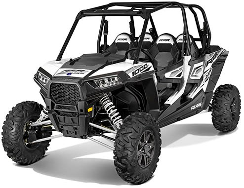


Located in Churchill County, just north of U.S. Highway 50, "The Loneliest Road in America," Sand Mountain is 25 miles east of Fallon, Nevada. The 4,795 acre recreation fee area is managed by the U. S. Department of the Interior, Bureau of Land Management (BLM). During the last ice age, Lake Lahontan covered much of what is now central Nevada. After the lake dried up, it left behind massive sand dunes at what is now Sand Mountain Recreation Area, 19 miles east of Fallon along Highway 50. Sand Mountain is a popular off-highway vehicle area, open to motorbikes, all-terrain vehicles and dune buggies, but it also offers hiking and biking opportunities. In quieter moments, listen carefully: the sand at Sand Mountain is the right size and silica composition to sing, moan and hum as it bounces over the dunes, a phenomenon that only occurs in a handful of deserts around the world.
Virgin Mountains


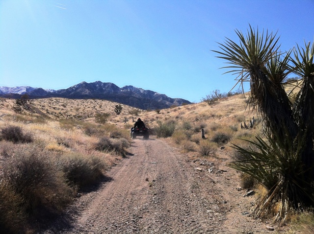
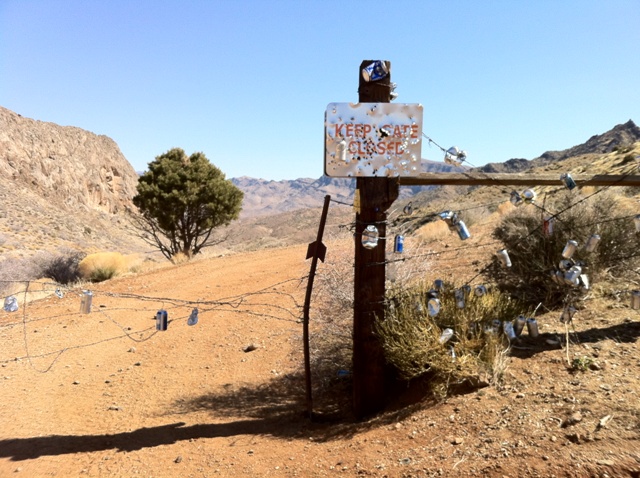
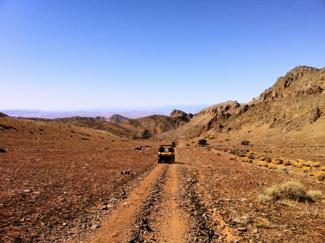
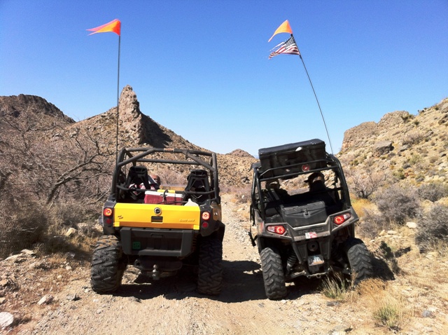
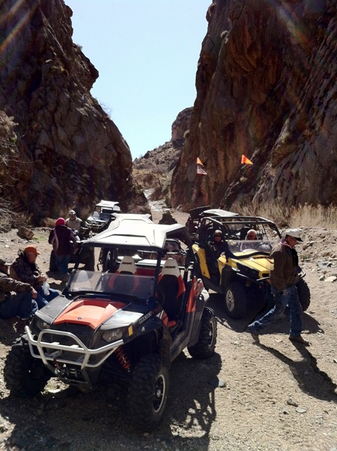
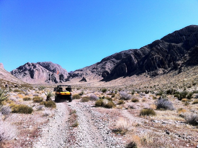
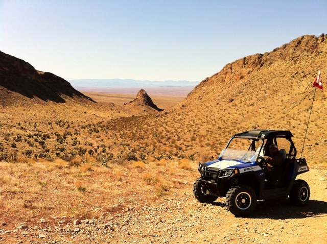
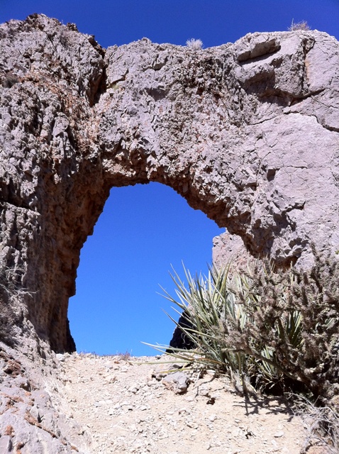
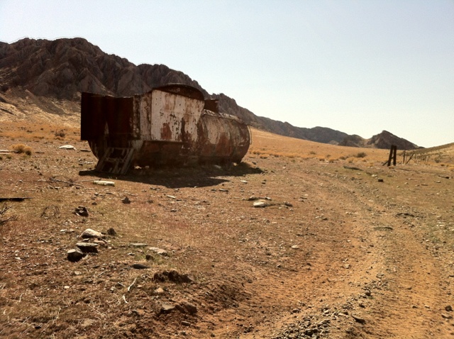
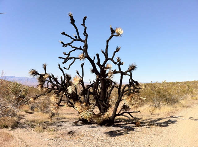
From I-15 heading south take the second Mesquite exit and turn under the overpass and left onto Mesquite Blvd SR-144 for .70 mile. Turn right on Riverside Blvd SR-170 after 1 mile veer to the left onto a gravel road and drive for about 6 miles south where you can park and unload from here by the tower.


 This trail begins in the town of Mason and travels past the remains of the Bluestone Mine and then through a narrow but scenic canyon within the hills of the Singatse Range. It ends at the intersection with Western #27: Ludwig Ghost Town Trail. Begin by following Nevada 339 north from Mason to the intersection with Weed Heights Road, near a massive tailings dump. From this intersection, the trail turns west toward the hills. There are numerous remains of the Bluestone Mine and near the Ludwig town site.

 To access these trails, ride along Alt 95 from Ft. Churchill or park at the trailhead area. The ride along the maintained dirt road is flat and offers great high desert scenery with mountains to the south and a large alkali flat to the north. At the end of the primary dirt road is a series of well used jeep roads adjoining several older jeep loops. To travel along the Carson River Drainage, take the first well used road to the northeast. This road can be ridden to the Lake Lahontan State Recreation Area.


 From Las Vegas take I-15 N to Exit 93 toward N Moapa Blvd. Turn right on N Moapa Blvd. Turn right on Liston and head west following the road (Mills/N Pioneer) as it turns to dirt and follows the train tracks north and then west again. There will be a large staging area with a kiosk.
 From Las Vegas, take I-15 south to the Blue Diamond exit and take SR 160 west. Go up the mountain and past Mountain Springs. As you're coming down from Mountain Springs, watch for a turnoff to Lovell Canyon Road which will be on your right. Follow this road for about 10 miles. The road makes a left where there's private property. Follow the graded dirt road to the left. In about 1/2 mile, you'll arrive at a parking area. The trailhead is across the dirt road from the parking area. This is an easy hike which can be done in a loop or you can do the trail from the trailhead to the Schaefer Springs Trail and then back, a distance of about 4.5 miles. You can do this hike and add the Schaefer Springs Trail to this one to make a nearly 2 mile longer hike. Mountain biking is not allowed on this trail.

 The best way to access the Mormon Mountains is off of I-15. Exit 100 entering on to Carp Road is the most common access point. Another place would be at Exit 111-112 just west of Mesquite. There is a truck resting area here. The dirt road going north alongside Hidden Valley Wash will get you into this area as well. From the north one can go through Caliente. Continue south on State Highway 317 through Elgin and Lyman Crossing to Carp, just above the northern corner of the Mormon Mountains Wilderness. To access the western edge of the Mormon Mountains take exit 90 off of I-15. Take HWY 168 west for just under three miles. Then turn North on Meadow Valley Road. This mountain range is about 60 miles Northeast of Las Vegas and about 25 miles Northwest of Mesquite, NV. It covers an area just under 250 square miles. The most hiked mountain in this range is Moapa Peak with its intriguing knife edge. The high point of this range is Mormon Peak at 7.414 feet. This holds a special spot on the Nevada Prominence list. It is one of Nevada�s 172 peaks with at least 2000 feet of prominence. It comes in at number 24 with 4,034 feet of prominence. This makes it the 3rd most prominent peak of southern Nevada after Charleston Peak and Hayford Peak. The Mormon Mountains are diversified with wildlife. You can find everything from lizards, snakes, bobcats, desert tortoises, toads, frogs, coyotes, and much more. There are also many species of birds too. The golden eagle and burrowing owl are just a few that can be found. The jagged peaks in this range are made of mostly of limestone. This was formed ages ago when shallow seas existed. Due to this many fossils can be found in the area. Gold was also once mined here as well at Whitmore Mine.


 From I-15 heading south take the second Mesquite exit and turn under the overpass and left onto Mesquite Blvd SR-144 for .70 mile. Turn right on Riverside Blvd SR-170 after 1 mile veer to the left onto a gravel road and drive for about 6 miles south where you can park and unload from here by the tower.